MyTopo
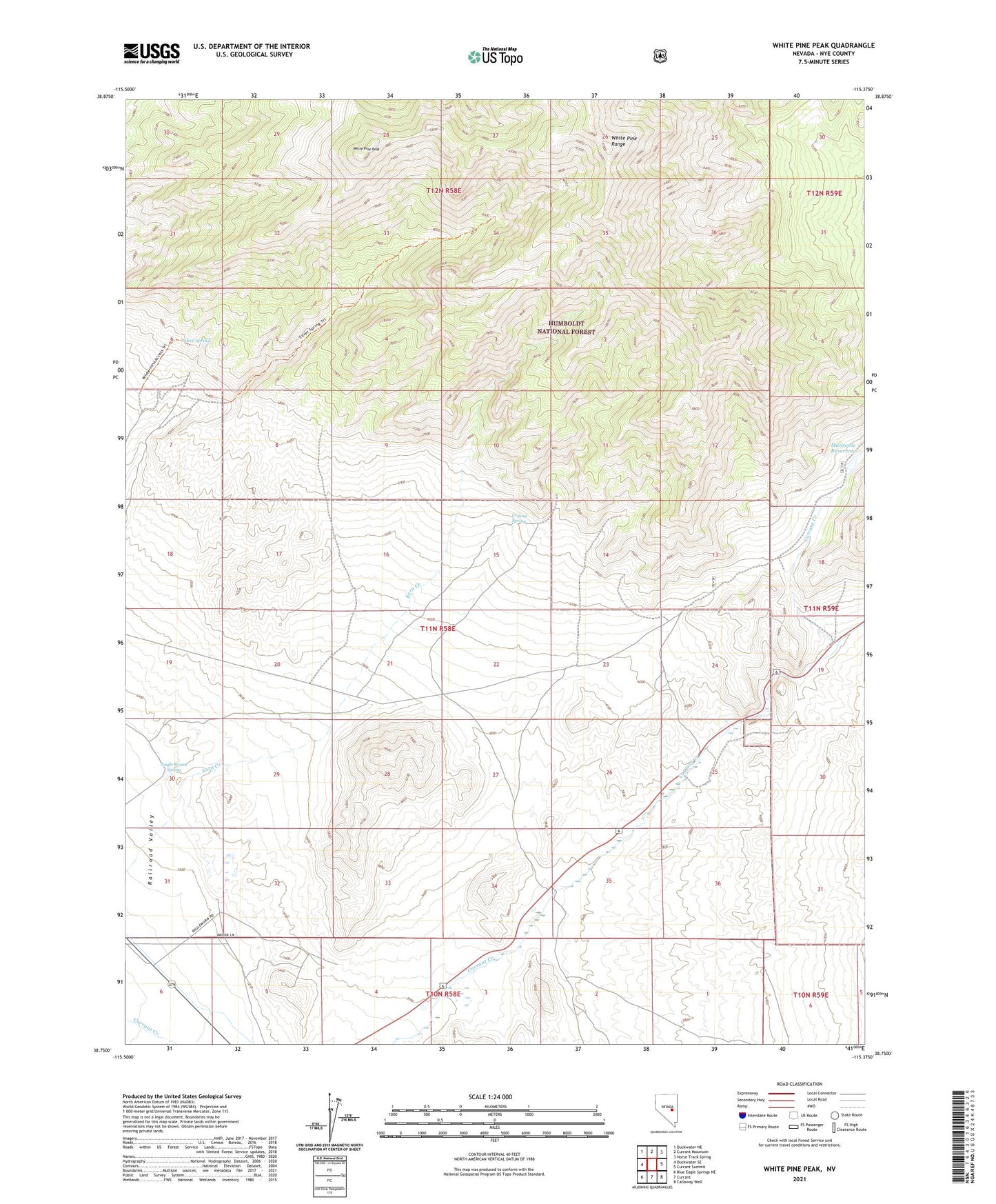
White Pine Peak Nevada US Topo Map
Couldn't load pickup availability
Also explore the White Pine Peak Forest Service Topo of this same quad for updated USFS data
2021 topographic map quadrangle White Pine Peak in the state of Nevada. Scale: 1:24000. Based on the newly updated USGS 7.5' US Topo map series, this map is in the following counties: Nye. The map contains contour data, water features, and other items you are used to seeing on USGS maps, but also has updated roads and other features. This is the next generation of topographic maps. Printed on high-quality waterproof paper with UV fade-resistant inks.
Quads adjacent to this one:
West: Duckwater SE
Northwest: Duckwater NE
North: Currant Mountain
Northeast: Horse Track Spring
East: Currant Summit
Southeast: Callaway Well
South: Currant
Southwest: Blue Eagle Springs NE
This map covers the same area as the classic USGS quad with code o38115g4.
Contains the following named places: Angle Worm Spring, Angleworm Ranch, Crystal Spring, Currant Creek School, Fisher Ranch, Lani Ranch, Manzone Ranch, Manzonie Dam, Silver Spring, White Pine Peak, White Pine Ranger District