MyTopo
Bottle Creek Ranch Nevada US Topo Map
Couldn't load pickup availability
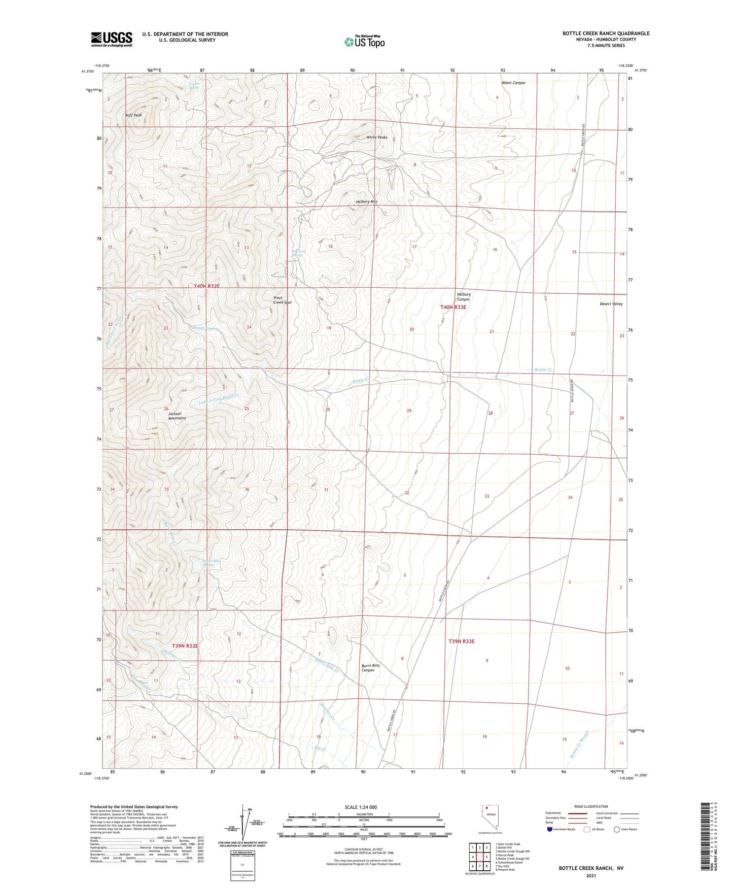
2021 topographic map quadrangle Bottle Creek Ranch in the state of Nevada. Scale: 1:24000. Based on the newly updated USGS 7.5' US Topo map series, this map is in the following counties: Humboldt. The map contains contour data, water features, and other items you are used to seeing on USGS maps, but also has updated roads and other features. This is the next generation of topographic maps. Printed on high-quality waterproof paper with UV fade-resistant inks.
Quads adjacent to this one:
West: Parrot Peak
Northwest: Deer Creek Peak
North: Bottle Hill
Northeast: Bottle Creek Slough NW
East: Bottle Creek Slough SW
Southeast: Presnel Well
South: Dry Hills
Southwest: Schoolhouse Butte
This map covers the same area as the classic USGS quad with code o41118c3.
Contains the following named places: Baldwin Mine, Big South Fork Bottle Creek, Birthday Mine, Blue Can Mine, Bottle Creek Mining District, Bottle Creek Ranch, Buff Peak, Burro Bills Canyon, Burro Bills Creek, Burro Bills Spring, Cricket Spring, Halburg Canyon, Halburg Mountain, Howison Spring, Jackson Mountain Elementary School, Little South Fork Bottle Creek, McAdoo Mine, Red Ore 1 Mine, Water Canyon, White Peaks, White Peaks Mine