MyTopo
Parrot Peak Nevada US Topo Map
Couldn't load pickup availability
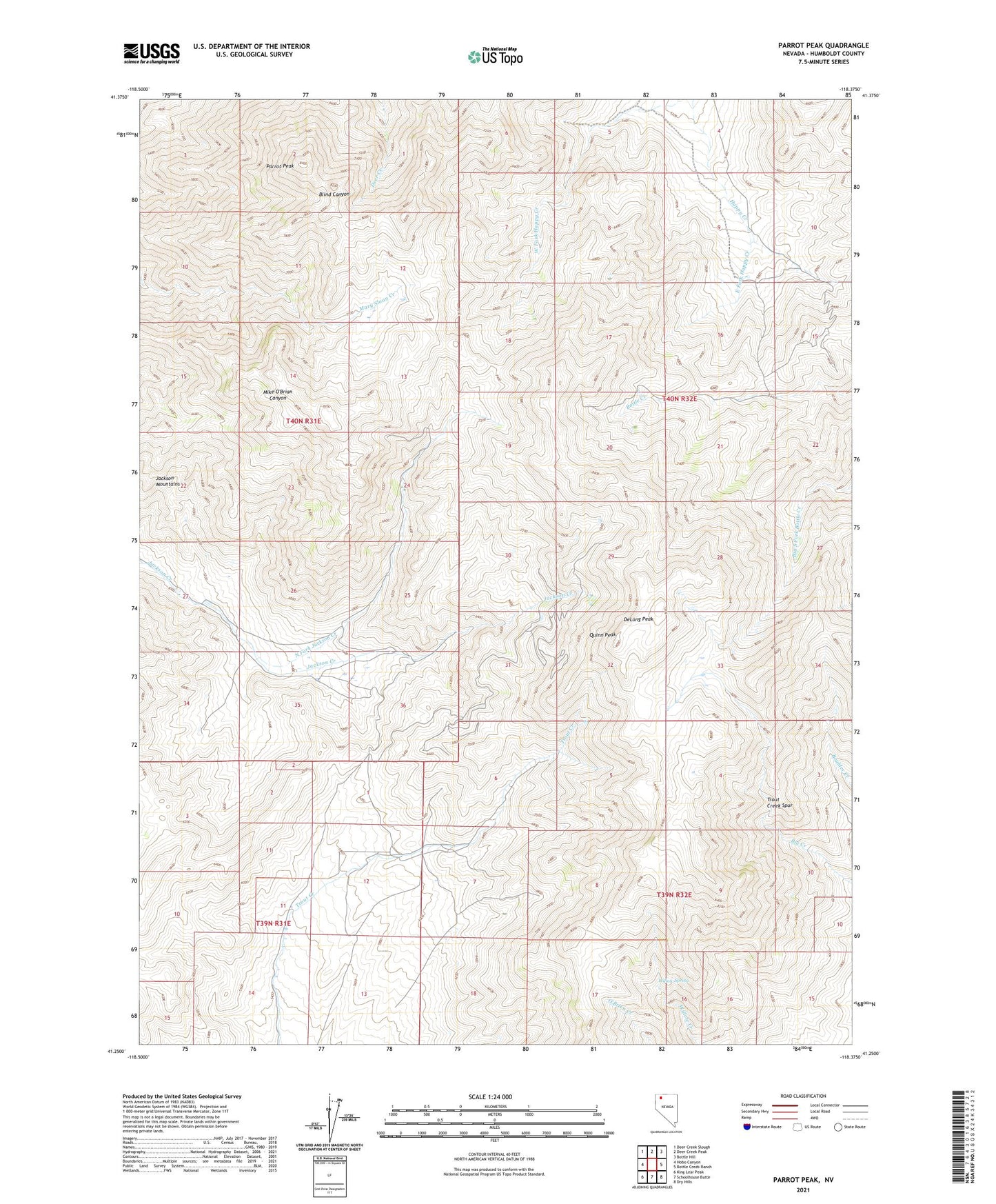
2021 topographic map quadrangle Parrot Peak in the state of Nevada. Scale: 1:24000. Based on the newly updated USGS 7.5' US Topo map series, this map is in the following counties: Humboldt. The map contains contour data, water features, and other items you are used to seeing on USGS maps, but also has updated roads and other features. This is the next generation of topographic maps. Printed on high-quality waterproof paper with UV fade-resistant inks.
Quads adjacent to this one:
West: Hobo Canyon
Northwest: Deer Creek Slough
North: Deer Creek Peak
Northeast: Bottle Hill
East: Bottle Creek Ranch
Southeast: Dry Hills
South: Schoolhouse Butte
Southwest: King Lear Peak
This map covers the same area as the classic USGS quad with code o41118c4.
Contains the following named places: Black Jack Mine, DeLong Peak, East Fork Happy Creek, Humboldt Mine, Iron King Mine, Jackson Creek Mining District, Jackson Mountains, Lay Ranch, Nelson Mine, North Fork Jackson Creek, North Jackson Mountains Wilderness, Parrot Peak, Quinn Peak, Redbird Mine, Trout Creek Spur, Willow Spring