
MyTopo
Buffalo Creek Nevada US Topo Map
Couldn't load pickup availability
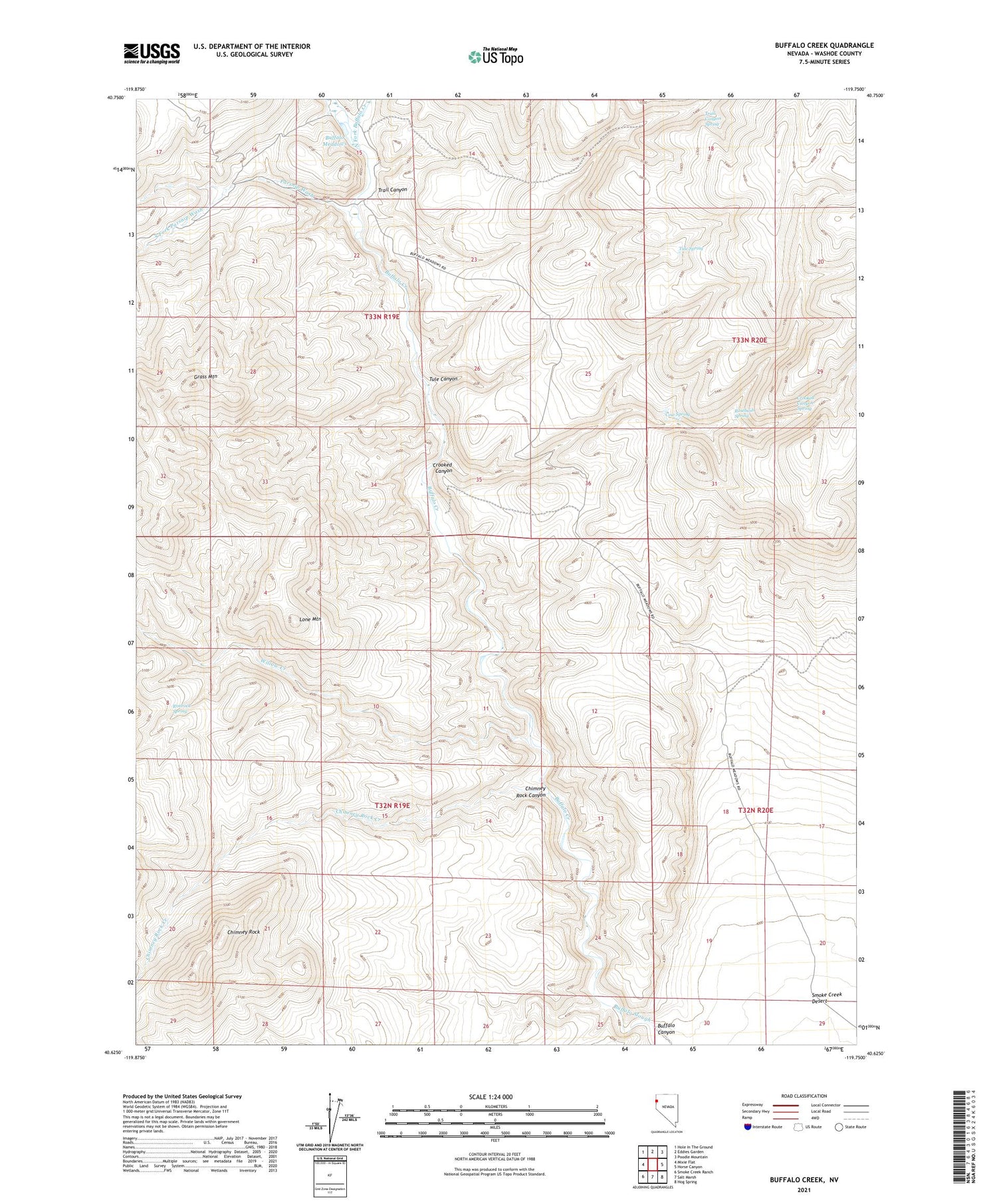
2021 topographic map quadrangle Buffalo Creek in the state of Nevada. Scale: 1:24000. Based on the newly updated USGS 7.5' US Topo map series, this map is in the following counties: Washoe. The map contains contour data, water features, and other items you are used to seeing on USGS maps, but also has updated roads and other features. This is the next generation of topographic maps. Printed on high-quality waterproof paper with UV fade-resistant inks.
Quads adjacent to this one:
West: Mixie Flat
Northwest: Hole In The Ground
North: Eddies Garden
Northeast: Poodle Mountain
East: Horse Canyon
Southeast: Hog Spring
South: Salt Marsh
Southwest: Smoke Creek Ranch
Contains the following named places: Buffalo Canyon, Buffalo Meadows, Buffalo Meadows Ranch, Buffalo Well, Chimney Rock, Chimney Rock Canyon, Chimney Rock Creek, Cow Spring, Crooked Canyon, Crooked Canyon Spring, Grass Mountain, Lone Mountain, North Fork Buffalo Creek, Parsnip Wash, Rimrock Spring, Rosebush Spring, South Fork Parsnip Wash, Trail Canyon, Trail Canyon Spring, Tule Canyon, Tule Spring, West Fork Buffalo Creek, Willow Creek


