MyTopo
Hole In The Ground Nevada US Topo Map
Couldn't load pickup availability
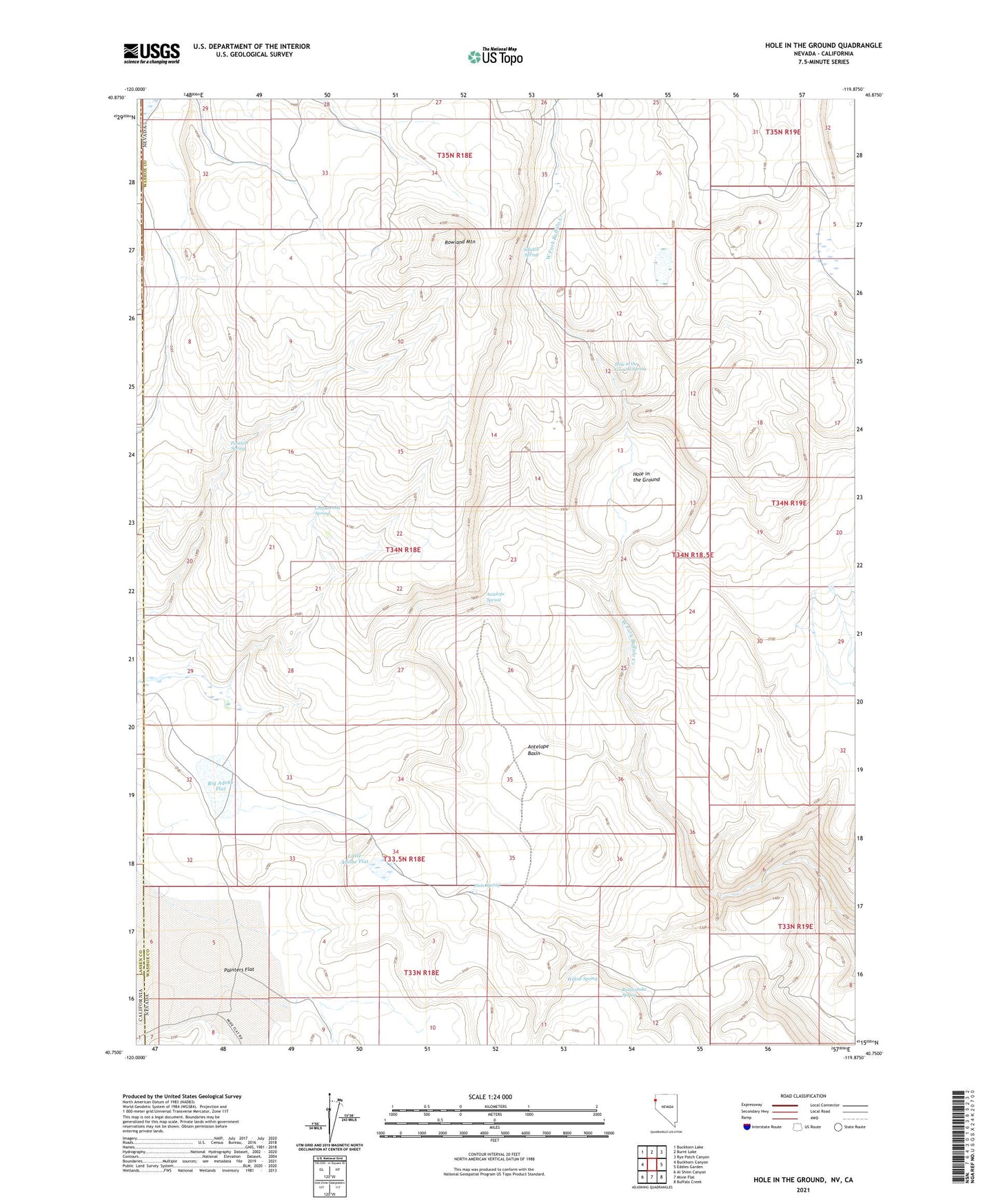
2021 topographic map quadrangle Hole In The Ground in the state of Nevada. Scale: 1:24000. Based on the newly updated USGS 7.5' US Topo map series, this map is in the following counties: Washoe, Lassen. The map contains contour data, water features, and other items you are used to seeing on USGS maps, but also has updated roads and other features. This is the next generation of topographic maps. Printed on high-quality waterproof paper with UV fade-resistant inks.
Quads adjacent to this one:
West: Buckhorn Canyon
Northwest: Buckhorn Lake
North: Burnt Lake
Northeast: Rye Patch Canyon
East: Eddies Garden
Southeast: Buffalo Creek
South: Mixie Flat
Southwest: Al Shinn Canyon
This map covers the same area as the classic USGS quad with code o40119g8.
Contains the following named places: Antelope Basin, Antelope Spring, Big Adobe Flat, Cottonwood Spring, Hole in the Ground, Hole in the Ground Spring, Little Adobe Flat, Madelin Mesa, Norton Place, Painter Ranch, Painters Spring, Piute Spring, Rattlesnake Spring, Rowland Mountain, Sidehill Spring, Willow Spring