MyTopo
Bullion Nevada US Topo Map
Couldn't load pickup availability
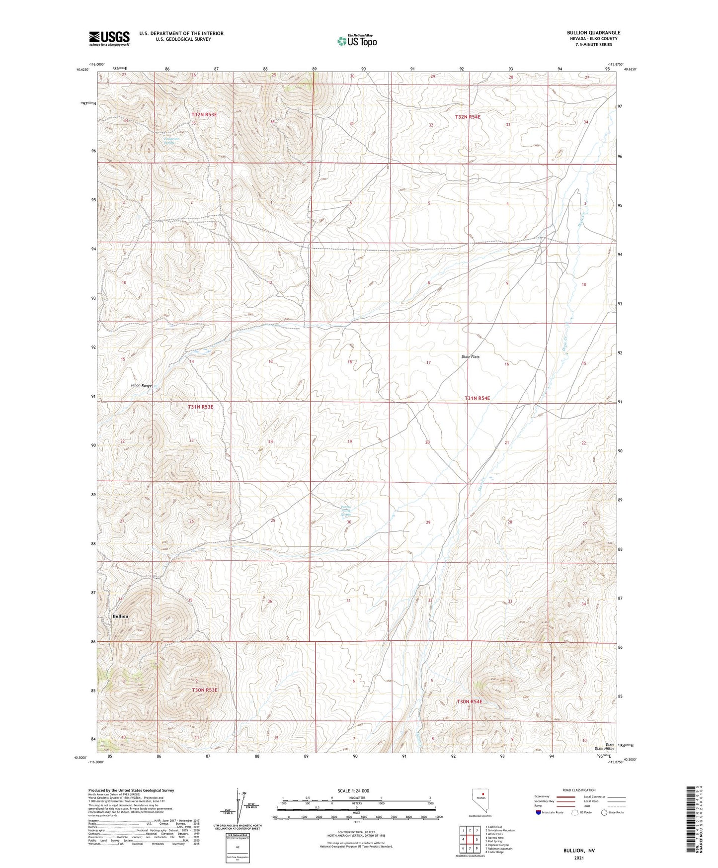
2021 topographic map quadrangle Bullion in the state of Nevada. Scale: 1:24000. Based on the newly updated USGS 7.5' US Topo map series, this map is in the following counties: Elko. The map contains contour data, water features, and other items you are used to seeing on USGS maps, but also has updated roads and other features. This is the next generation of topographic maps. Printed on high-quality waterproof paper with UV fade-resistant inks.
Quads adjacent to this one:
West: Ravens Nest
Northwest: Carlin East
North: Grindstone Mountain
Northeast: White Flats
East: Red Spring
Southeast: Cedar Ridge
South: Robinson Mountain
Southwest: Papoose Canyon
This map covers the same area as the classic USGS quad with code o40115e8.
Contains the following named places: Bullion, Bullion Post Office, Davis Tunnel, Dixie Flats, Elliot Ranch, Elliott Ranch, Emigrant Spring, Highland, Old Bullion, Potato Patch Spring, Railroad Mining District, Scott Ranch, Upper Scott Ranch