MyTopo
Ravens Nest Nevada US Topo Map
Couldn't load pickup availability
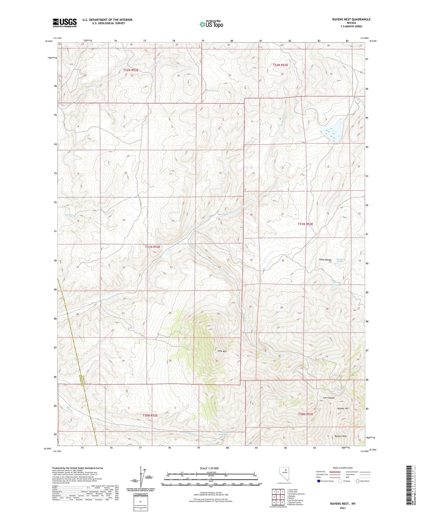
2021 topographic map quadrangle Ravens Nest in the state of Nevada. Scale: 1:24000. Based on the newly updated USGS 7.5' US Topo map series, this map is in the following counties: Elko, Eureka. The map contains contour data, water features, and other items you are used to seeing on USGS maps, but also has updated roads and other features. This is the next generation of topographic maps. Printed on high-quality waterproof paper with UV fade-resistant inks.
Quads adjacent to this one:
West: Palisade
Northwest: Carlin West
North: Carlin East
Northeast: Grindstone Mountain
East: Bullion
Southeast: Robinson Mountain
South: Papoose Canyon
Southwest: McCormack Spring
This map covers the same area as the classic USGS quad with code o40116e1.
Contains the following named places: Brodine Mine, Bullion Mine, Bunker Hill, Burke Mine, Cherry Springs, Copper Bell Mine, Delmas Mine, Ennor Mine, Grey Eagle Mine, Helen M Mine, Independence Mine, Key Mine, Mahogany Mine, Mendota Mine, Mill Creek Spring, Murdock Spring, Palisade Mine, Pine Mountain, Pinon Range, Ravens Nest, Red Bird Mine, Red Springs, Silver King Mine, Sky Blue Mine, Standing Elk Mine, Storm King Mine, Stump Spring, Sweepstake Mine, Sylvania Mine, Tripoli Mine, Webb Creek, Webb Ranch, Webfoot Mine