MyTopo
Papoose Canyon Nevada US Topo Map
Couldn't load pickup availability
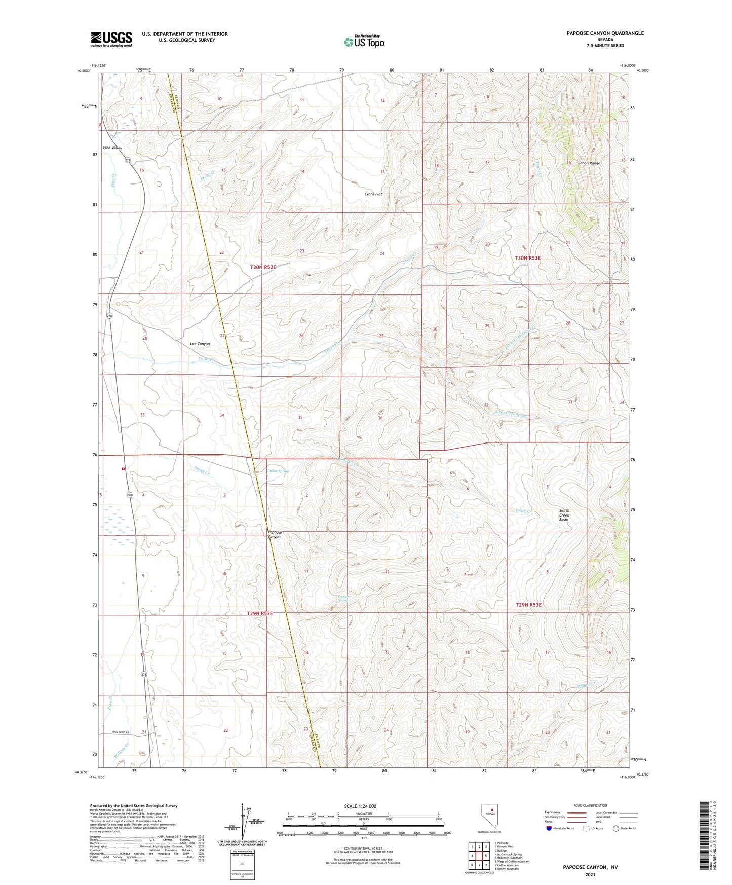
2021 topographic map quadrangle Papoose Canyon in the state of Nevada. Scale: 1:24000. Based on the newly updated USGS 7.5' US Topo map series, this map is in the following counties: Elko, Eureka. The map contains contour data, water features, and other items you are used to seeing on USGS maps, but also has updated roads and other features. This is the next generation of topographic maps. Printed on high-quality waterproof paper with UV fade-resistant inks.
Quads adjacent to this one:
West: McCormack Spring
Northwest: Palisade
North: Ravens Nest
Northeast: Bullion
East: Robinson Mountain
Southeast: Bailey Mountain
South: Coffin Mountain
Southwest: West of Coffin Mountain
This map covers the same area as the classic USGS quad with code o40116d1.
Contains the following named places: Bailey Ranch, Dixie Fork Trout Creek, Evans, Evans Flat, Front Creek, Hay Ranch, Indian Campground, Indian Spring, Lee Canyon, Papoose Canyon, Papoose Spring, Pine Valley Volunteer Fire Department, Smith Creek, Smith Creek Basin, South Fork Trout Creek, Willards, Willow Creek