MyTopo
Bunejug Mountains Nevada US Topo Map
Couldn't load pickup availability
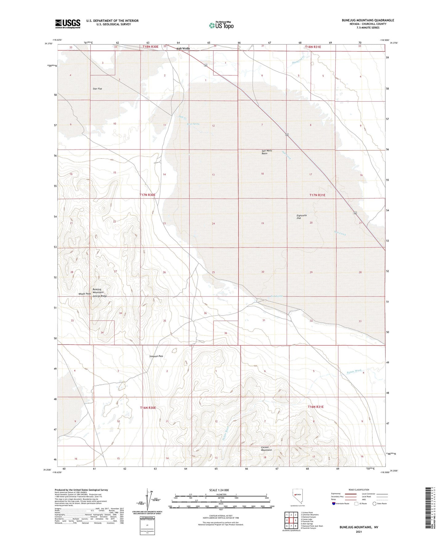
2021 topographic map quadrangle Bunejug Mountains in the state of Nevada. Scale: 1:24000. Based on the newly updated USGS 7.5' US Topo map series, this map is in the following counties: Churchill. The map contains contour data, water features, and other items you are used to seeing on USGS maps, but also has updated roads and other features. This is the next generation of topographic maps. Printed on high-quality waterproof paper with UV fade-resistant inks.
Quads adjacent to this one:
West: Carson Lake
Northwest: Grimes Point
North: Lahontan Mountains
Northeast: Diamond Canyon
East: Fourmile Flat
Southeast: Fourmile Canyon
South: Diamond Field Jack Wash
Southwest: Allen Springs
This map covers the same area as the classic USGS quad with code o39118c5.
Contains the following named places: Borax Spring, Bunejug Mountains, Diamond Creek, Eightmile Flat, George Ridge, Lattin Well, Paiute Wash, Pony Express Monument, Rock Springs, Simpson Pass, Star Flat, Water Station, Wheat Peak