MyTopo
Grimes Point Nevada US Topo Map
Couldn't load pickup availability
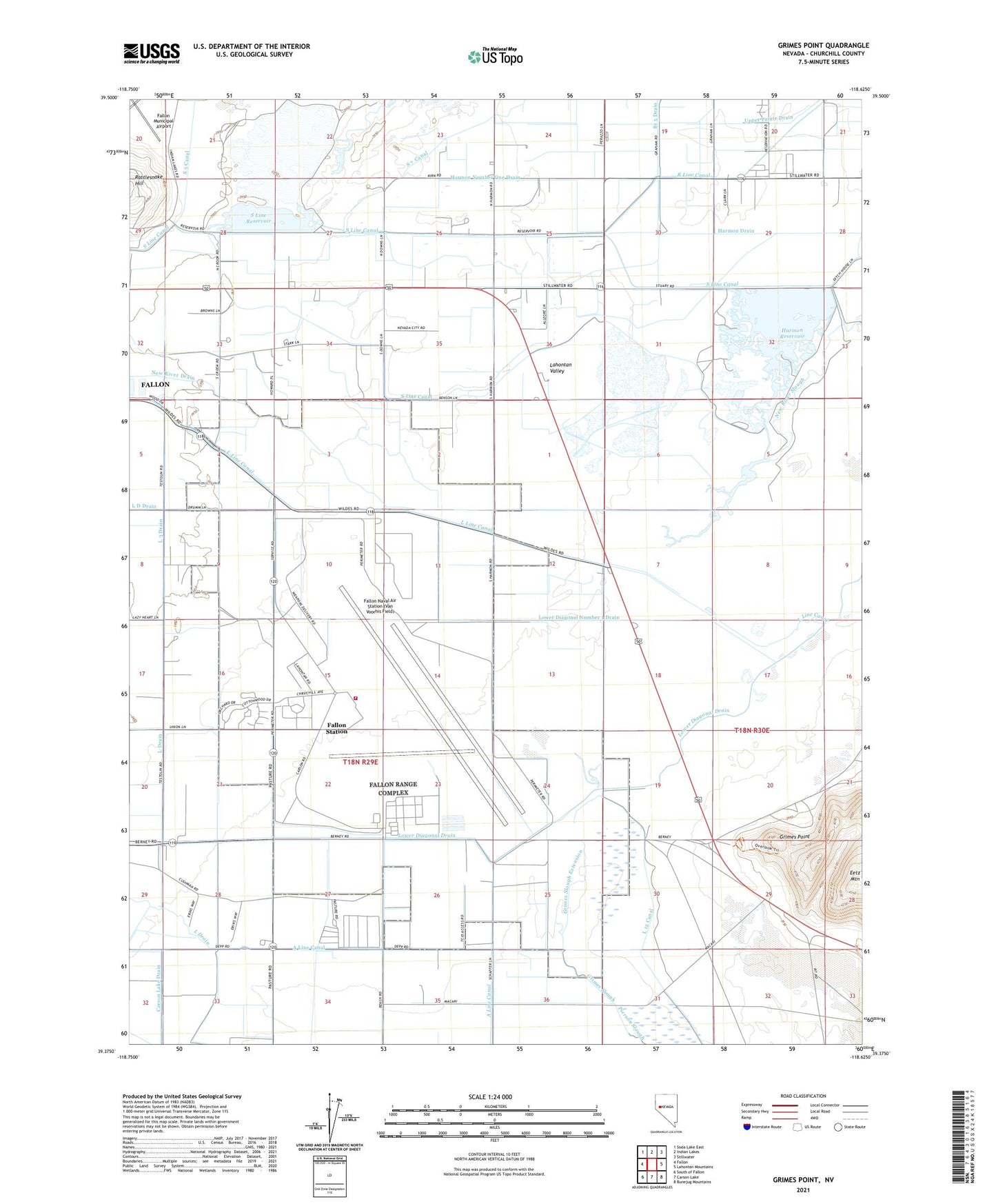
2021 topographic map quadrangle Grimes Point in the state of Nevada. Scale: 1:24000. Based on the newly updated USGS 7.5' US Topo map series, this map is in the following counties: Churchill. The map contains contour data, water features, and other items you are used to seeing on USGS maps, but also has updated roads and other features. This is the next generation of topographic maps. Printed on high-quality waterproof paper with UV fade-resistant inks.
Quads adjacent to this one:
West: Fallon
Northwest: Soda Lake East
North: Indian Lakes
Northeast: Stillwater
East: Lahontan Mountains
Southeast: Bunejug Mountains
South: Carson Lake
Southwest: South of Fallon
This map covers the same area as the classic USGS quad with code o39118d6.
Contains the following named places: Branch 5 Drain, Carson Lake Drain, D Canal, Eetz Mountain, Fallon Naval Air Station (Van Voorhis Field), Fallon Naval Air Station Federal Fire Department, Fallon Radio Range Station, Fallon Station Census Designated Place, Grimes Point, Grimes Slough, Grimes Slough Extension, Harmon Drain, Harmon Number One Drain, Harmon Reservoir, Harmon School, Hill, Hill Post Office, L 12 Canal, L 3 Drain, L Drain, Lower Diagonal Number 1 Drain, Naval Air Station Fallon, Naval Air Station Fallon Fire Station 2, Nevada City, Nevada Feed and Cattle, New River Drain, R Line Canal, Redmans, S 7 Canal, S Line Canal, S Line Dam, S Line Reservoir, Salt Well Junction, S-One Canal, S-Two Canal, Wallace-Taylor Ranch