MyTopo
Lahontan Mountains Nevada US Topo Map
Couldn't load pickup availability
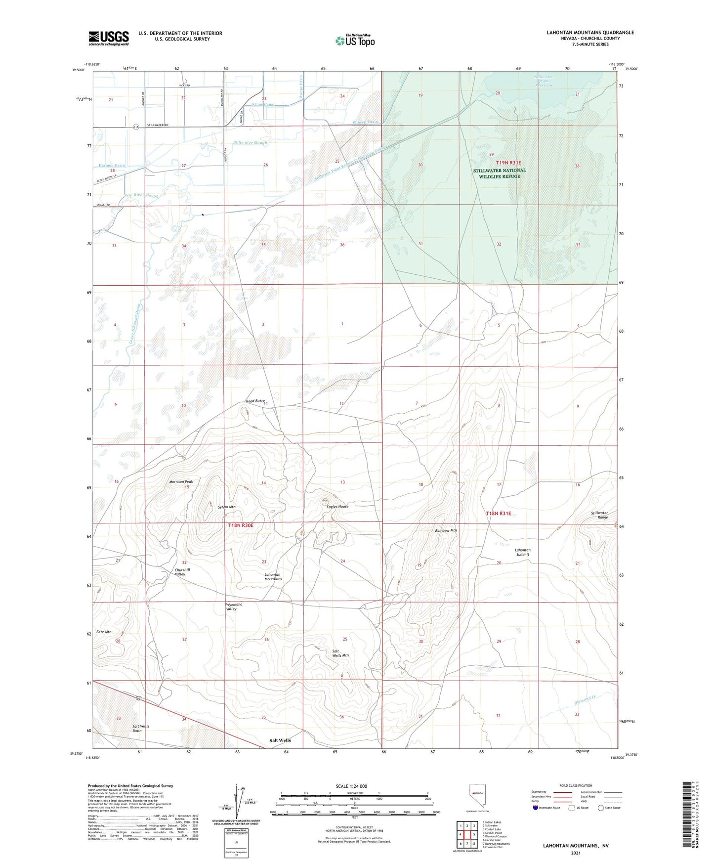
2021 topographic map quadrangle Lahontan Mountains in the state of Nevada. Scale: 1:24000. Based on the newly updated USGS 7.5' US Topo map series, this map is in the following counties: Churchill. The map contains contour data, water features, and other items you are used to seeing on USGS maps, but also has updated roads and other features. This is the next generation of topographic maps. Printed on high-quality waterproof paper with UV fade-resistant inks.
Quads adjacent to this one:
West: Grimes Point
Northwest: Indian Lakes
North: Stillwater
Northeast: Foxtail Lake
East: Diamond Canyon
Southeast: Fourmile Flat
South: Bunejug Mountains
Southwest: Carson Lake
This map covers the same area as the classic USGS quad with code o39118d5.
Contains the following named places: Churchill Valley, Eagles House, Gravel Pit Windmill, Grimes Point Recreation Site, Kent Well, Kent Well Number 2, Lahontan Mountains, Lahontan Summit, Lower Diagonal Drain, Morrison Peak, New River Slough, Rainbow Mountain, Reed Butte, Salt Well, Salt Wells, Salt Wells Mountain, Sehoo Mountain, Stillwater Point Reservoir Diversion Canal, Winsett Drain, Wyemaha Valley