MyTopo
Dodge Spring Utah US Topo Map
Couldn't load pickup availability
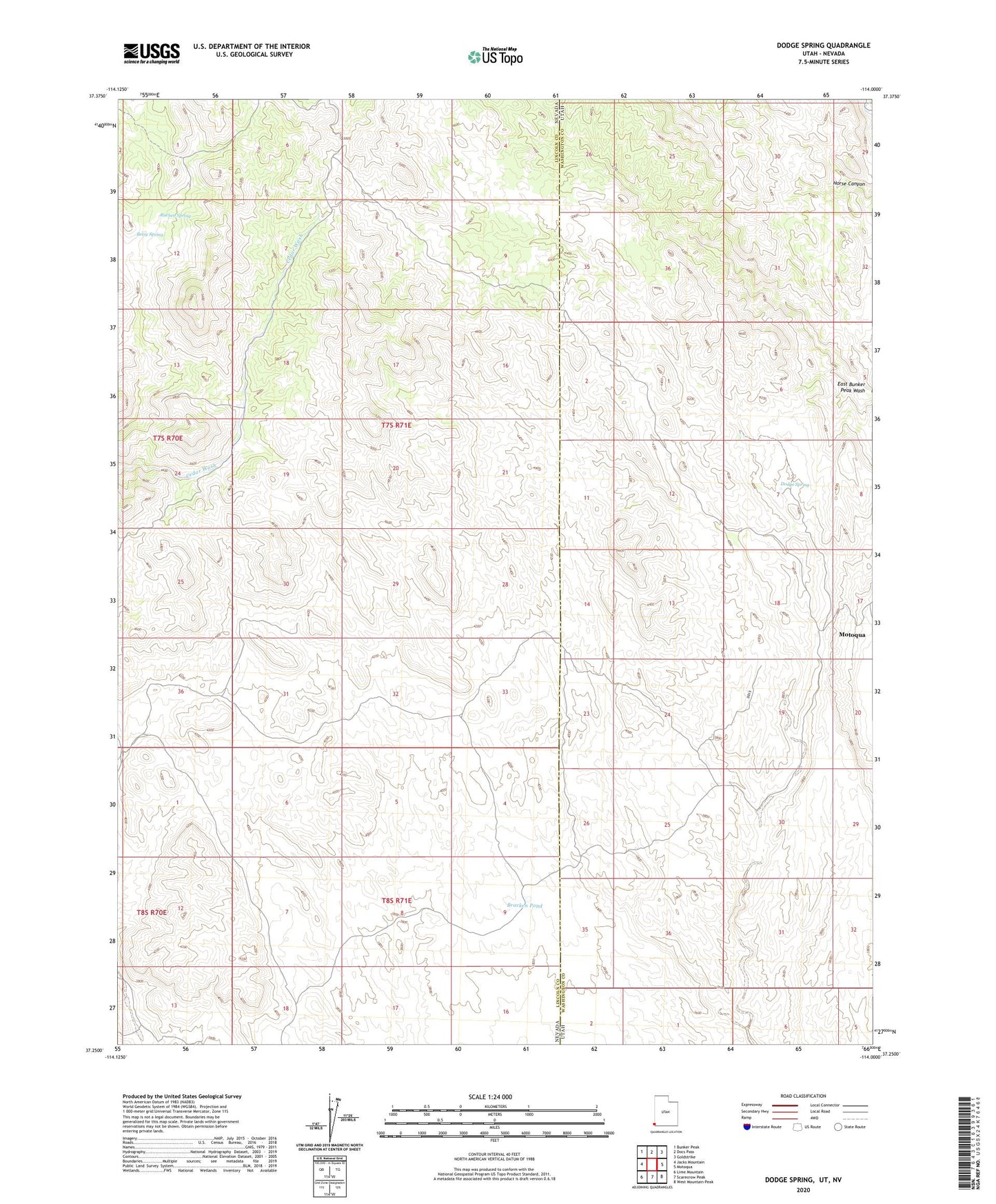
2023 topographic map quadrangle Dodge Spring in the states of Nevada, Utah. Scale: 1:24000. Based on the newly updated USGS 7.5' US Topo map series, this map is in the following counties: Washington, Lincoln. The map contains contour data, water features, and other items you are used to seeing on USGS maps, but also has updated roads and other features. This is the next generation of topographic maps. Printed on high-quality waterproof paper with UV fade-resistant inks.
Quads adjacent to this one:
West: Jacks Mountain
Northwest: Bunker Peak
North: Docs Pass
Northeast: Goldstrike
East: Motoqua
Southeast: West Mountain Peak
South: Scarecrow Peak
Southwest: Lime Mountain
This map covers the same area as the classic USGS quad with code o37114c1.
Contains the following named places: Betsy Spring, Bracken Pond, Dodge Spring, Halfway Camp, Ooze Flat Reservoir, Rueben Spring, Upper Lime Mountain Well