MyTopo
Coaldale Nevada US Topo Map
Couldn't load pickup availability
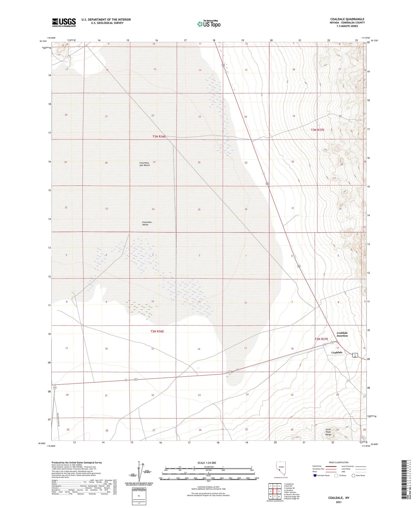
2021 topographic map quadrangle Coaldale in the state of Nevada. Scale: 1:24000. Based on the newly updated USGS 7.5' US Topo map series, this map is in the following counties: Esmeralda. The map contains contour data, water features, and other items you are used to seeing on USGS maps, but also has updated roads and other features. This is the next generation of topographic maps. Printed on high-quality waterproof paper with UV fade-resistant inks.
Quads adjacent to this one:
West: Columbus
Northwest: Candelaria
North: Rock Hill
Northeast: Coaldale NE
East: Blair Junction
Southeast: Rhyolite Ridge NE
South: Rhyolite Ridge NW
Southwest: Volcanic Hills East
This map covers the same area as the classic USGS quad with code o38117a8.
Contains the following named places: Argentum, Calmville, Calmville Post Office, Coaldale, Coaldale Airport, Coaldale Junction, Coaldale Post Office, Columbia Valley, Columbus Marsh Mining District, Columbus Salt Marsh, Gates Mill, Goodwins Borax Works, Marotts Borax Works, Micrometal Mine, Smith and Companys Borax Mill, Turners Borax Works