MyTopo
Candelaria Nevada US Topo Map
Couldn't load pickup availability
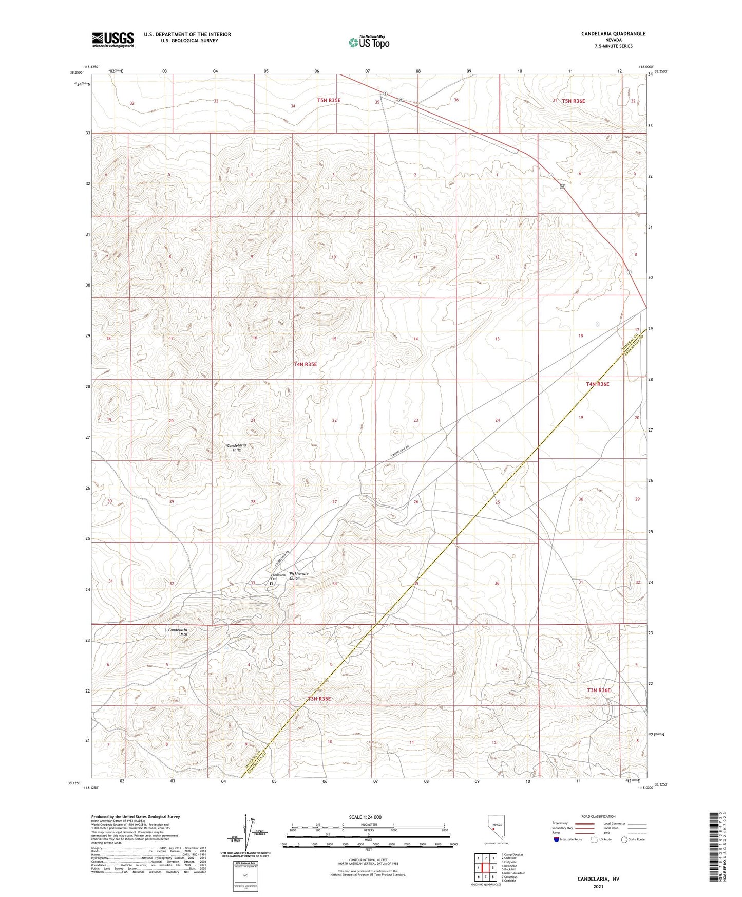
2021 topographic map quadrangle Candelaria in the state of Nevada. Scale: 1:24000. Based on the newly updated USGS 7.5' US Topo map series, this map is in the following counties: Mineral, Esmeralda. The map contains contour data, water features, and other items you are used to seeing on USGS maps, but also has updated roads and other features. This is the next generation of topographic maps. Printed on high-quality waterproof paper with UV fade-resistant inks.
Quads adjacent to this one:
West: Belleville
Northwest: Camp Douglas
North: Sodaville
Northeast: Eddyville
East: Rock Hill
Southeast: Coaldale
South: Columbus
Southwest: Miller Mountain
This map covers the same area as the classic USGS quad with code o38118b1.
Contains the following named places: Argentum Mine, Bellmarte Mine, Black Metallic Mine, Blanch Mine, Boak Mine, Candelaria, Candelaria Cemetery, Candelaria Hills, Candelaria Mines Company Mill, Candelaria Mining District, Candelaria Mountain, Candelaria Post Office, Candelaria Water Works and Milling Company Mill, Columbus Consolidated Mine, Columbus Mine, Equator Mine, Figge Hoblyn Mine, Georgine Mine, Hecla Mine, Lucky Hill Mine, Metallic City, Metallic Mine, Metallic Post Office, Metallic-Equator Joint Shaft, Mount Diablo Mine, New Potosi Mine, Newmont Mine, Northern Belle Mine, Pappinaux Mine, Peru Mine, Petrol Mine, Pickhandle Gulch, Potosi Mine, Princess Mine, Swastika Mine, The Victor Mine, Vulture Mine