MyTopo
Cortez Nevada US Topo Map
Couldn't load pickup availability
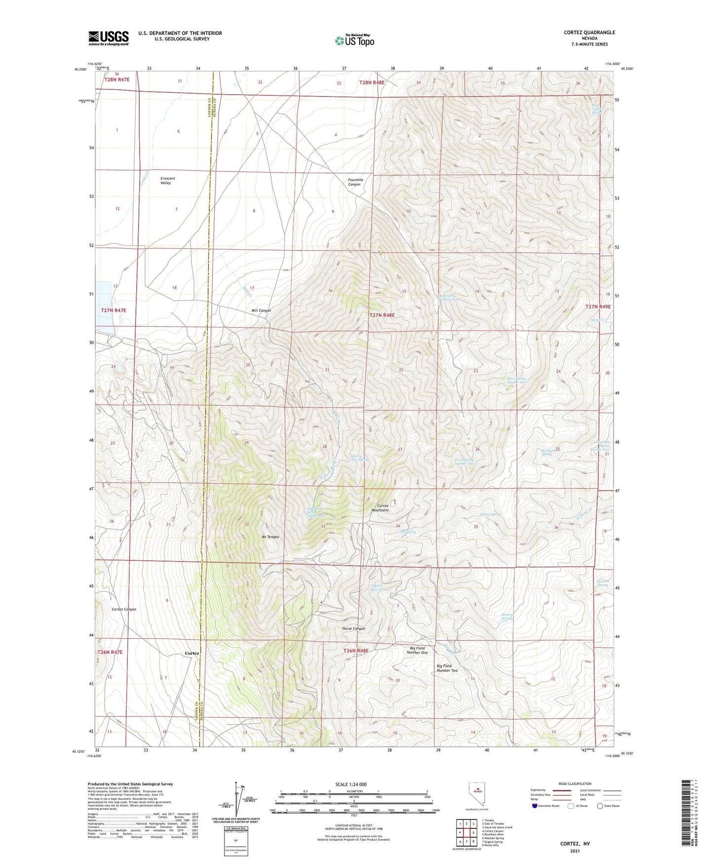
2021 topographic map quadrangle Cortez in the state of Nevada. Scale: 1:24000. Based on the newly updated USGS 7.5' US Topo map series, this map is in the following counties: Eureka, Lander. The map contains contour data, water features, and other items you are used to seeing on USGS maps, but also has updated roads and other features. This is the next generation of topographic maps. Printed on high-quality waterproof paper with UV fade-resistant inks.
Quads adjacent to this one:
West: Cortez Canyon
Northwest: Tenabo
North: East of Tenabo
Northeast: Hand-me-down Creek
East: Buckhorn Mine
Southeast: Rocky Hills
South: Dugout Spring
Southwest: Wenban Spring
Contains the following named places: Artic Mine, Benjamin Harrison Mine, Berlin Mine, Big Field Number One, Big Field Number Two, Buckhorn Spring, Bullion Hill Mine, Caledonia Mine, Cherry Tree Spring, Cortez, Cortez Gold Mine, Cortez Mine, Cortez Post Office, Cortez-Mill Canyon Mining District, Dean Spring Number One, Dean Spring Number Three, Dean Spring Number Two, Empire State Mine, Falconer Mine, Fitzgerald Mine, Fourmile Canyon, Goyeneche Spring Number Four, Goyeneche Spring Number Six, Lewis Canyon Mines, Mill Canyon, Mill Canyon Mine, Mill Canyon School, Mill Creek, Mount Tenabo, Mount Tenabo Mine, Mule Canyon Spring, New York Mine, Rimrock Spring, Rimrock Springs, Rock House, Saint Louis Mine, Sidehill Blue Spring, Tub Spring, West Fork Mill Creek, Willow Spring