MyTopo
Buckhorn Mine Nevada US Topo Map
Couldn't load pickup availability
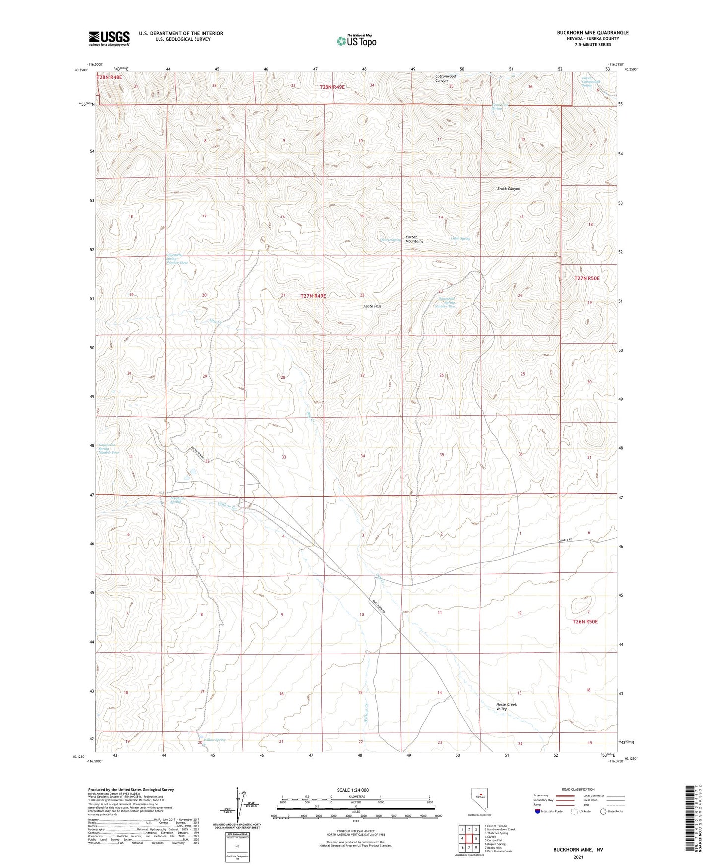
2021 topographic map quadrangle Buckhorn Mine in the state of Nevada. Scale: 1:24000. Based on the newly updated USGS 7.5' US Topo map series, this map is in the following counties: Eureka. The map contains contour data, water features, and other items you are used to seeing on USGS maps, but also has updated roads and other features. This is the next generation of topographic maps. Printed on high-quality waterproof paper with UV fade-resistant inks.
Quads adjacent to this one:
West: Cortez
Northwest: East of Tenabo
North: Hand-me-down Creek
Northeast: Thatcher Spring
East: Curlow Flat
Southeast: Pete Hanson Creek
South: Rocky Hills
Southwest: Dugout Spring
This map covers the same area as the classic USGS quad with code o40116b4.
Contains the following named places: Agate Pass, Allison Ranch, Buckhorn, Buckhorn Mine, Buckhorn Mine Airport, Buckhorn Mining District, Buckhorn Post Office, Cabin Spring, Goyeneche Spring Number Three, Goyeneche Spring Number Two, Horse Creek Valley, Lower Cottonwood Spring, Potato Patch Spring, Quartz Spring, Secquira Spring, South Gate Spring, Willow Spring