MyTopo
Cottonwood Pass Nevada US Topo Map
Couldn't load pickup availability
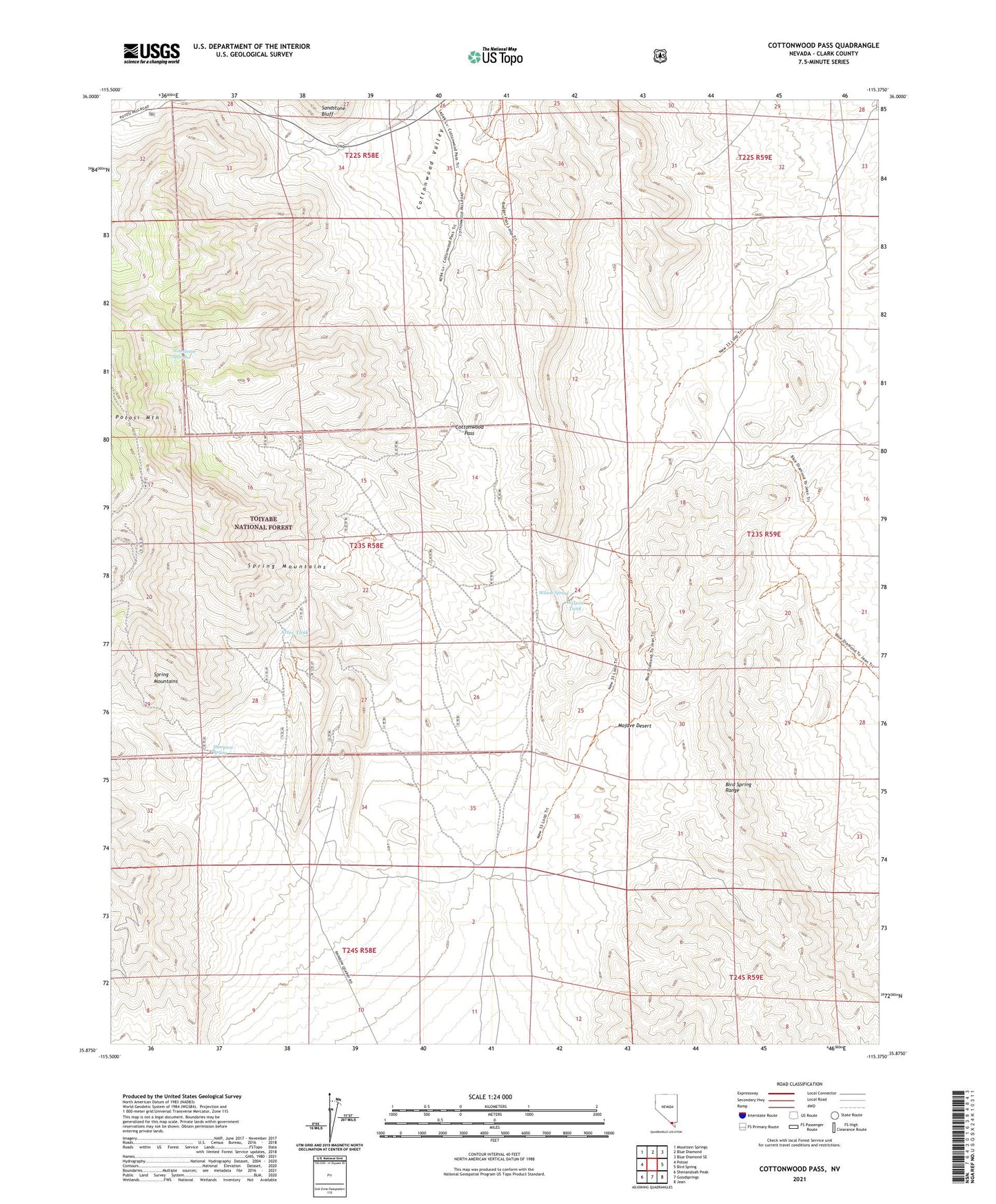
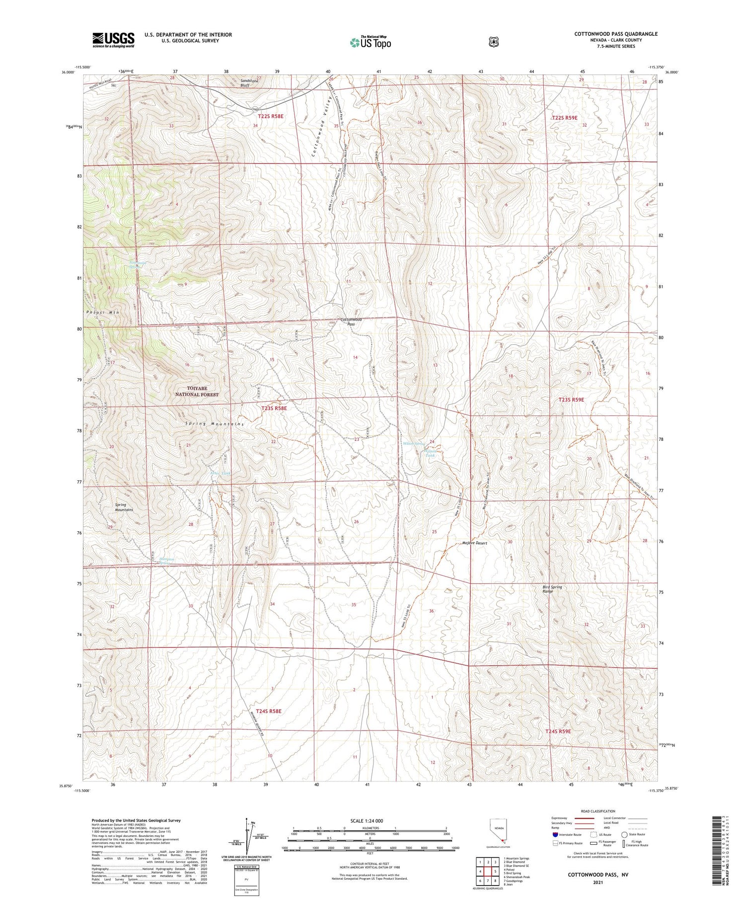
2021 topographic map quadrangle Cottonwood Pass in the state of Nevada. Scale: 1:24000. Based on the newly updated USGS 7.5' US Topo map series, this map is in the following counties: Clark. The map contains contour data, water features, and other items you are used to seeing on USGS maps, but also has updated roads and other features. This is the next generation of topographic maps. Printed on high-quality waterproof paper with UV fade-resistant inks.
Quads adjacent to this one:
West: Potosi
Northwest: Mountain Springs
North: Blue Diamond
Northeast: Blue Diamond SE
East: Bird Spring
Southeast: Jean
South: Goodsprings
Southwest: Shenandoah Peak
Contains the following named places: Aztec Tank, Bird Spring Range, Bluejay Mine, Contact Mine, Cottonwood Pass, Dawn Mine, Double Up Mine, Hampton Spring, Ninetynine Mine, Ninetynine Spring, Pauline Mine, Potosi Tower, Rainbow Quarries, Red Bluff Mine, Snowstorm Mine, Wilson Spring, Wilson Tank