MyTopo
Goodsprings Nevada US Topo Map
Couldn't load pickup availability
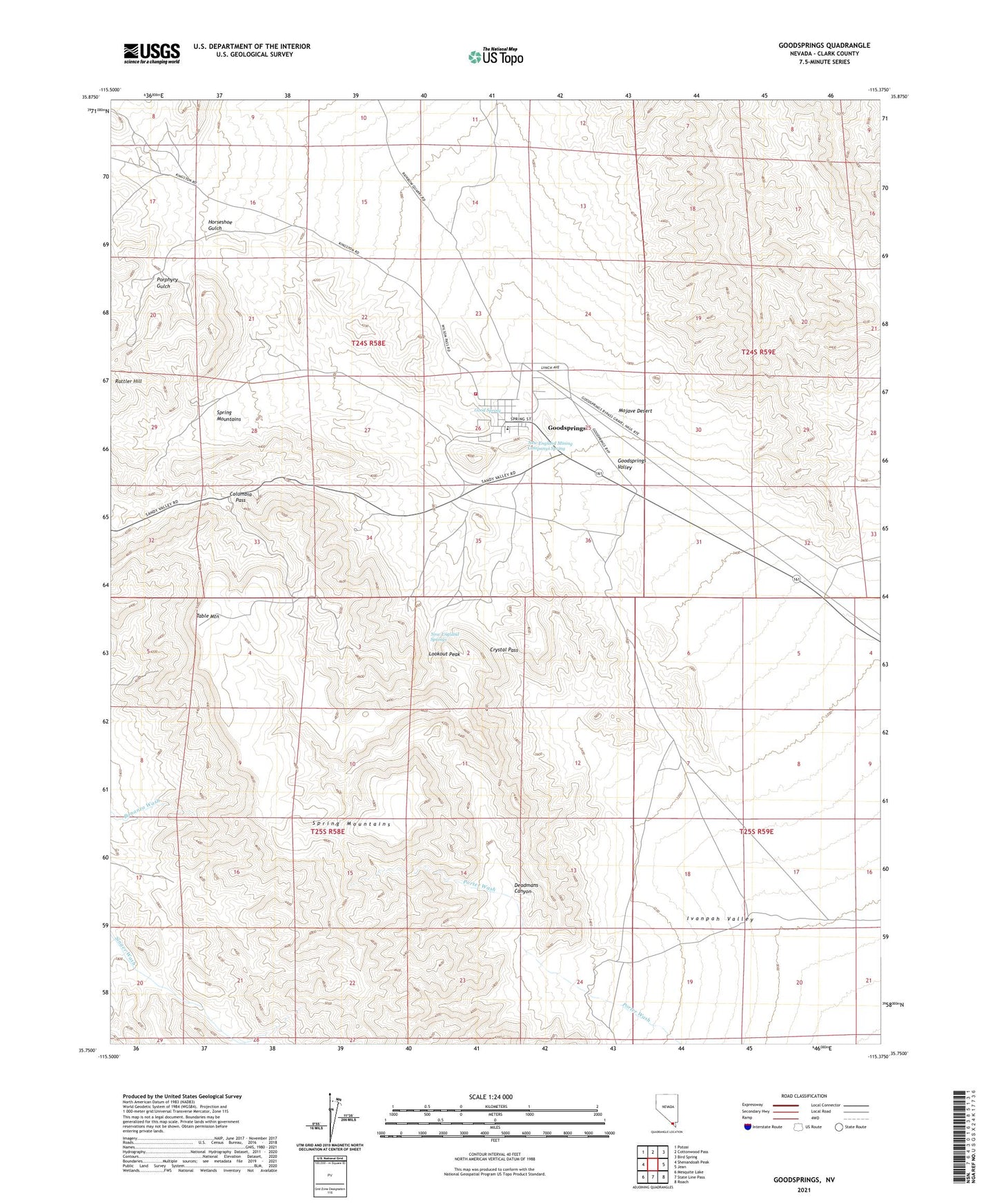
2021 topographic map quadrangle Goodsprings in the state of Nevada. Scale: 1:24000. Based on the newly updated USGS 7.5' US Topo map series, this map is in the following counties: Clark. The map contains contour data, water features, and other items you are used to seeing on USGS maps, but also has updated roads and other features. This is the next generation of topographic maps. Printed on high-quality waterproof paper with UV fade-resistant inks.
Quads adjacent to this one:
West: Shenandoah Peak
Northwest: Potosi
North: Cottonwood Pass
Northeast: Bird Spring
East: Jean
Southeast: Roach
South: State Line Pass
Southwest: Mesquite Lake
This map covers the same area as the classic USGS quad with code o35115g4.
Contains the following named places: Accident Mine, Alice Mine, Anchor Mine, Argentena Mine, Argentena Mine Camp, Belle Mine, Bullion Mine, Clark County Fire Department Station 78, Columbia Mine, Columbia Pass, Cosmopolitan Mine, Crystal Pass, Deadmans Canyon, Frederickson Mine, Good Spring, Goodsprings, Goodsprings Census Designated Place, Goodsprings Elementary School, Goodsprings Park, Goodsprings Rural Station Post Office, Goodsprings Valley, Green Copper Mine, Hermosa Mine, Hoosier Mine, Horseshoe Gulch, Houghton Mine, Ireland Mine, Iron Gold Mine, Lavina Mine, Lincoln Mine, Lookout Mine, Lookout Peak, Middlesex Mine, Monte Cristo Mine, Mountain Top Mine, New England Mining Companys Spring, New England Springs, Pilgrim Mine, Porphyry Gulch, Porter Mine, Porter Wash, Prairie Flower Mine, Puelz Mine, Red Cloud Mine, Ruth Mine, Star Mine, Surprise Mine, Table Mountain, Valentine Mine, Volcano Mine, Yellow Pine Mine