MyTopo
Crescent Valley Nevada US Topo Map
Couldn't load pickup availability
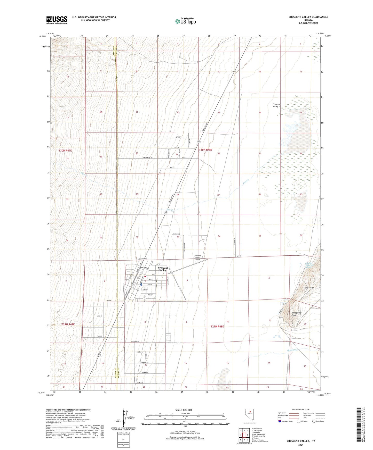
2021 topographic map quadrangle Crescent Valley in the state of Nevada. Scale: 1:24000. Based on the newly updated USGS 7.5' US Topo map series, this map is in the following counties: Eureka, Lander. The map contains contour data, water features, and other items you are used to seeing on USGS maps, but also has updated roads and other features. This is the next generation of topographic maps. Printed on high-quality waterproof paper with UV fade-resistant inks.
Quads adjacent to this one:
West: Mud Spring Gulch
Northwest: Mule Canyon
North: The Geysers
Northeast: Beowawe
East: Tumbleweed Flat
Southeast: Hand-me-down Creek
South: East of Tenabo
Southwest: Tenabo
This map covers the same area as the classic USGS quad with code o40116d5.
Contains the following named places: Crescent Valley, Crescent Valley Airport, Crescent Valley Ambulance Service, Crescent Valley Census Designated Place, Crescent Valley Elementary School, Crescent Valley Hot Springs, Crescent Valley Medical Center, Crescent Valley Village Post Office, Crescent Valley Volunteer Fire Department, Fire Creek, Great Basin College Crescent Valley Satellite Center, Hot Springs Point, Hot Springs Point Mine, Well Number Eight