MyTopo
Currant Nevada US Topo Map
Couldn't load pickup availability
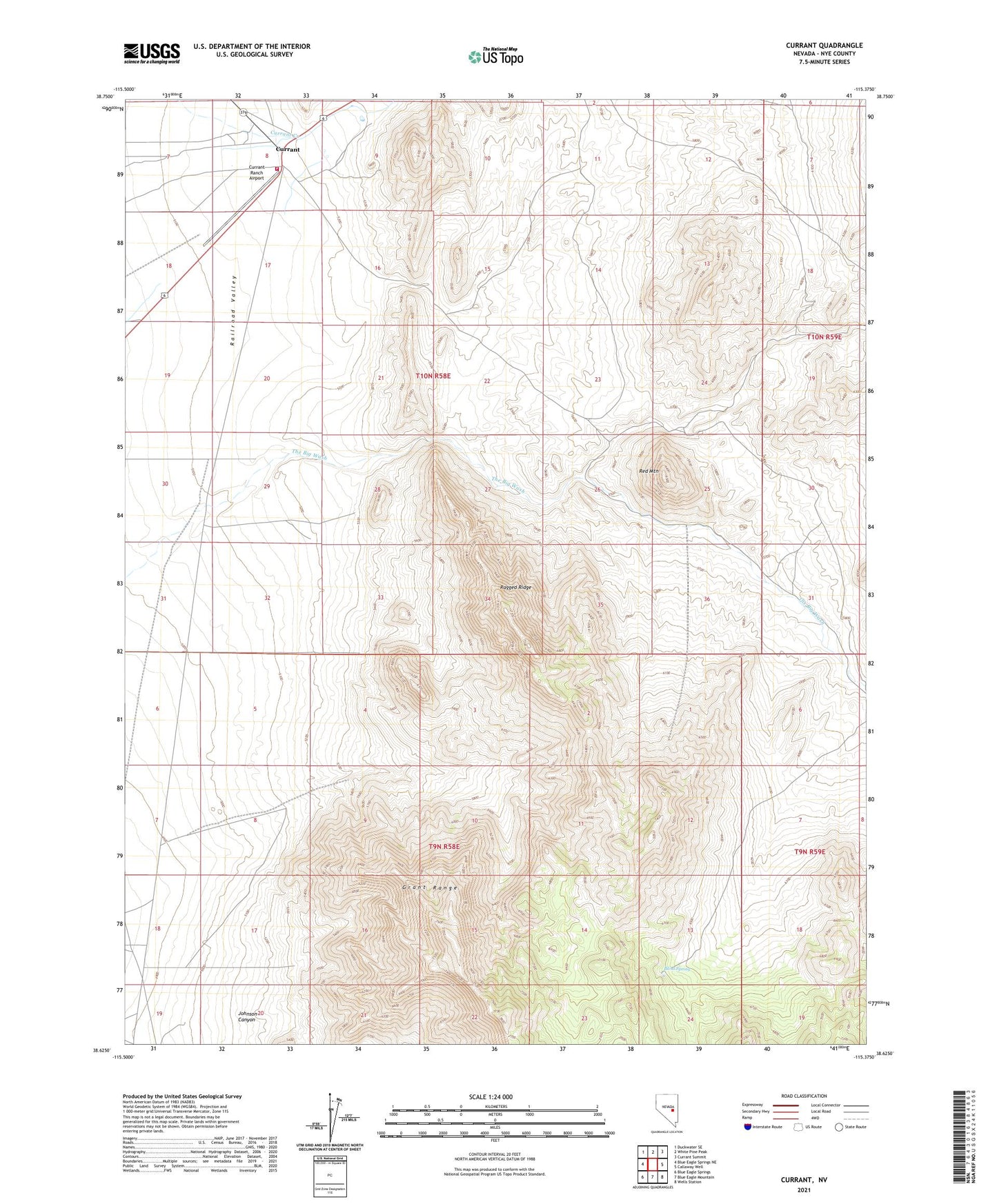
2021 topographic map quadrangle Currant in the state of Nevada. Scale: 1:24000. Based on the newly updated USGS 7.5' US Topo map series, this map is in the following counties: Nye. The map contains contour data, water features, and other items you are used to seeing on USGS maps, but also has updated roads and other features. This is the next generation of topographic maps. Printed on high-quality waterproof paper with UV fade-resistant inks.
Quads adjacent to this one:
West: Blue Eagle Springs NE
Northwest: Duckwater SE
North: White Pine Peak
Northeast: Currant Summit
East: Callaway Well
Southeast: Wells Station
South: Blue Eagle Mountain
Southwest: Blue Eagle Springs
Contains the following named places: Blind Spring, Callaway Ranch, Currant, Currant Creek Volunteer Fire Department, Currant Mining District, Currant Post Office, Currant Ranch Airport, El Padre Mine, Johnson Canyon, Ragged Ridge, Red Mountain