MyTopo
Delamar Nevada US Topo Map
Couldn't load pickup availability
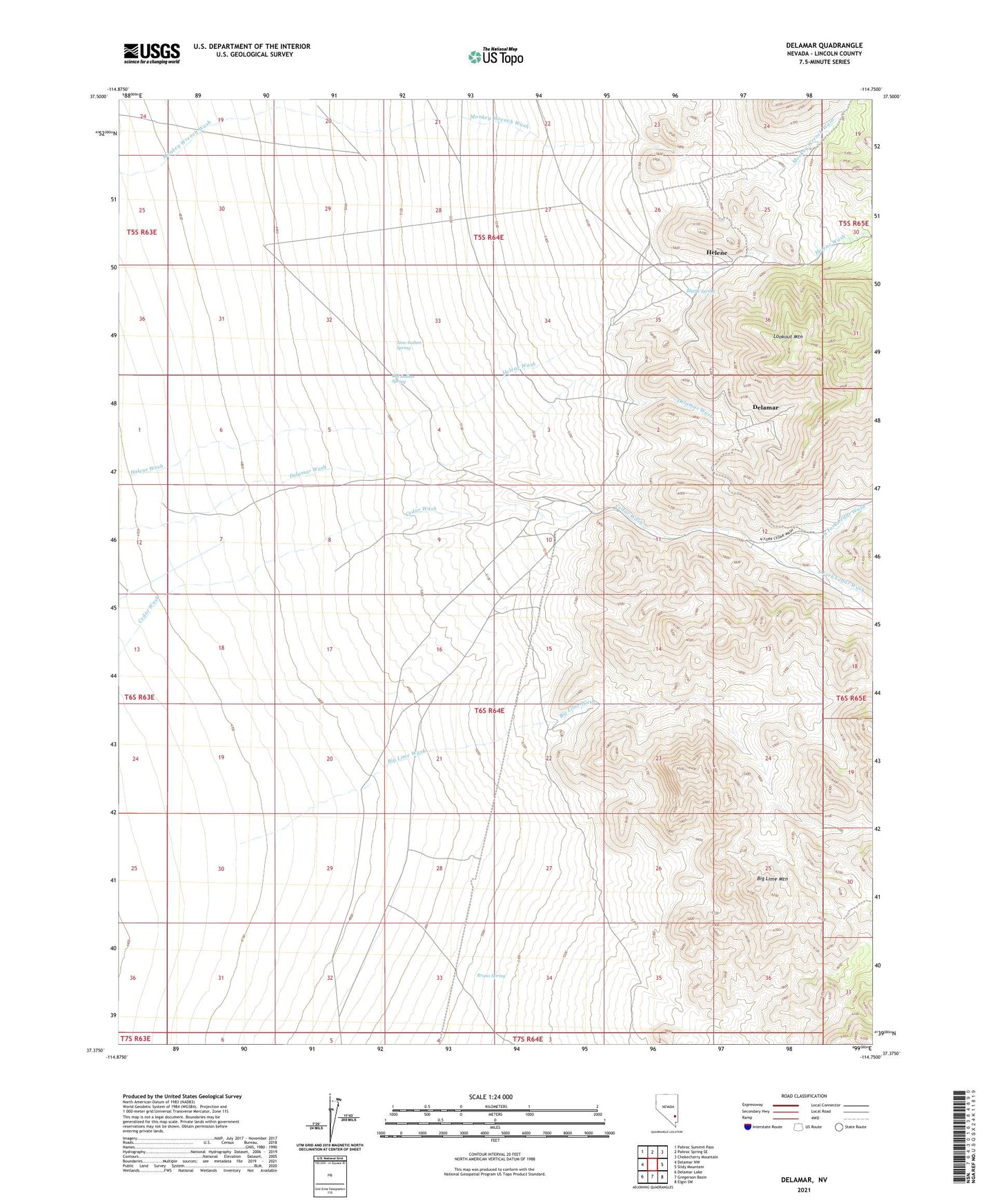
2021 topographic map quadrangle Delamar in the state of Nevada. Scale: 1:24000. Based on the newly updated USGS 7.5' US Topo map series, this map is in the following counties: Lincoln. The map contains contour data, water features, and other items you are used to seeing on USGS maps, but also has updated roads and other features. This is the next generation of topographic maps. Printed on high-quality waterproof paper with UV fade-resistant inks.
Quads adjacent to this one:
West: Delamar NW
Northwest: Pahroc Summit Pass
North: Pahroc Spring SE
Northeast: Chokecherry Mountain
East: Slidy Mountain
Southeast: Elgin SW
South: Gregerson Basin
Southwest: Delamar Lake
This map covers the same area as the classic USGS quad with code o37114d7.
Contains the following named places: April Fool Mine, Big Lime Mountain, Big Lime Wash, Blythe Spring, Bruno Spring, Culverwell Mine, Delamar, Delamar Mine, Delamar Mining District, Delamar Post Office, Delamar Zink Mine, Ferguson, Helene, Helene Post Office, Helene Wash, Hogpen Shoot, Jim Crow Mine, Jumbo Mine, Lookout Mountain, Lucky Bar Mine, Magnolia Mine, Monitor Mine, Monkey Wrench Mine, New Indian Spring, North Fork Cedar Wash, Old Indian Spring, South Fork Cedar Wash