MyTopo
Diamond Springs Nevada US Topo Map
Couldn't load pickup availability
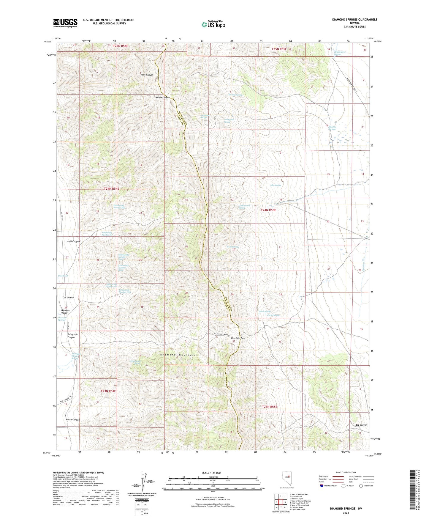
2021 topographic map quadrangle Diamond Springs in the state of Nevada. Scale: 1:24000. Based on the newly updated USGS 7.5' US Topo map series, this map is in the following counties: Eureka, White Pine. The map contains contour data, water features, and other items you are used to seeing on USGS maps, but also has updated roads and other features. This is the next generation of topographic maps. Printed on high-quality waterproof paper with UV fade-resistant inks.
Quads adjacent to this one:
West: West of Diamond Springs
Northwest: West of Railroad Pass
North: Railroad Pass
Northeast: Walker Canyon
East: Cold Creek Ranch NW
Southeast: Cold Creek Ranch
South: Christina Peak
Southwest: West of Christina Peak
This map covers the same area as the classic USGS quad with code o39115h7.
Contains the following named places: Alba Spring, Big Canyon, Birch, Birch Post Office, Carpenter Spring, Corta Spring, Cottonwood Spring, Cox Canyon, Cupperville, Diammond Springs Station, Diamond Springs, Duck Pond, Echemendy Number Eight, Echemendy Number Five, Echemendy Number Nine, Echemendy Number Seven, Echemendy Number Six, Echemendy Number Ten, Headwaters Springs, Heath Spring, Horse Canyon, Huntington Creek Mining Area, Ivirs City, Judd Canyon, Meadow Springs, Murray Spring, Overland Pass, Portuguese Spring, Rock Springs, Telegraph Canyon, Thompson Ranch, Thompson Ranch Spring