MyTopo
Dixie Valley SE Nevada US Topo Map
Couldn't load pickup availability
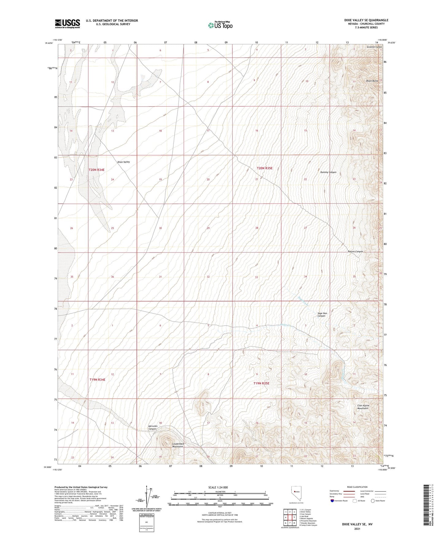
2021 topographic map quadrangle Dixie Valley SE in the state of Nevada. Scale: 1:24000. Based on the newly updated USGS 7.5' US Topo map series, this map is in the following counties: Churchill. The map contains contour data, water features, and other items you are used to seeing on USGS maps, but also has updated roads and other features. This is the next generation of topographic maps. Printed on high-quality waterproof paper with UV fade-resistant inks.
Quads adjacent to this one:
West: Job Peak
Northwest: I X L Canyon
North: Dixie Valley
Northeast: Cow Canyon
East: Mount Augusta
Southeast: Camp Creek Canyon
South: Wonder Mountain
Southwest: Pirouette Mountain
This map covers the same area as the classic USGS quad with code o39118e1.
Contains the following named places: Black Butte, Dixie Valley Division, Dummy Canyon, Hercules Canyon, Horse Creek, Horse Creek Ranch, Paiute Canyon, Sage Hen Canyon, Sagehen Creek