MyTopo
Pyramid SW Nevada US Topo Map
Couldn't load pickup availability
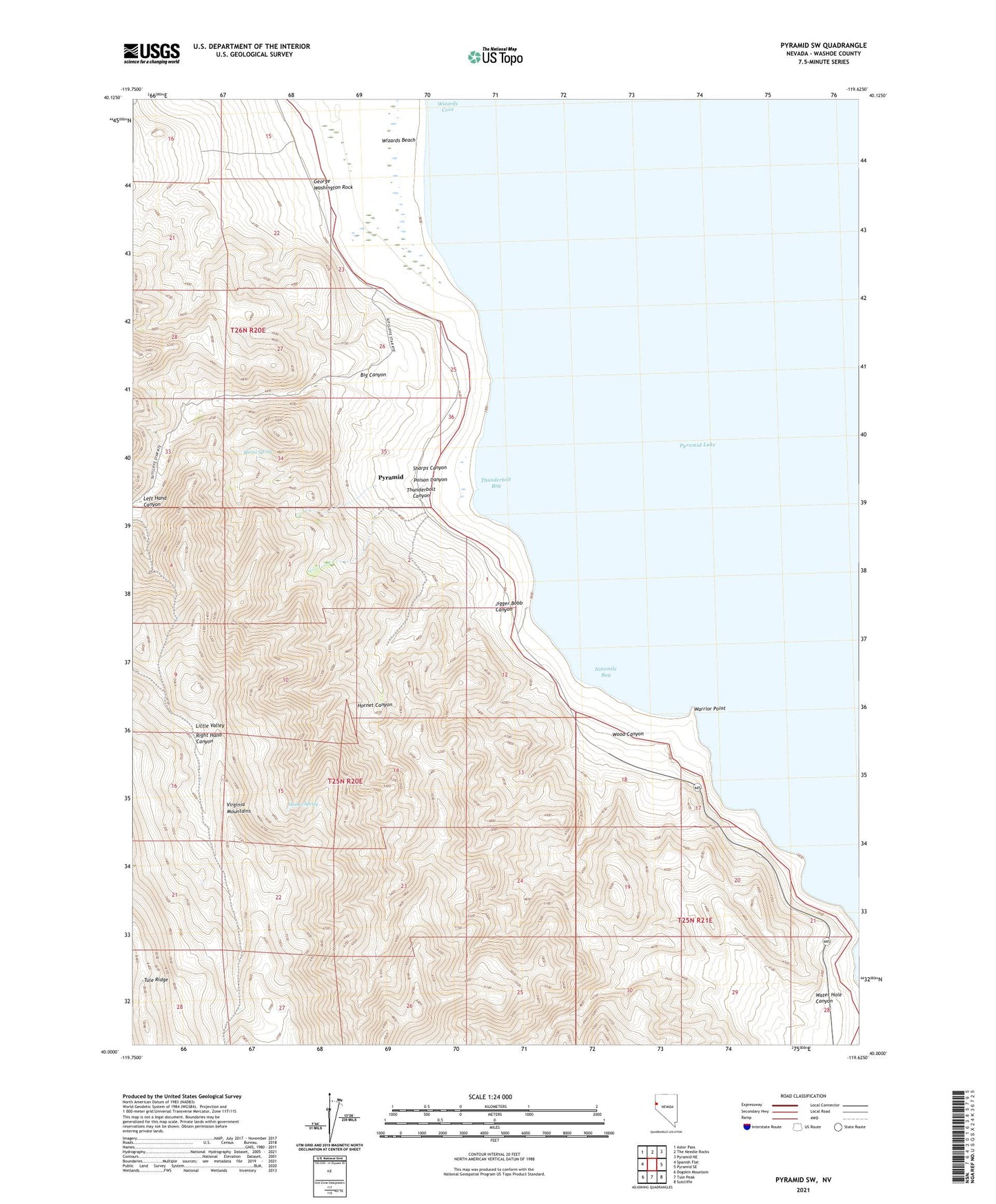
2021 topographic map quadrangle Pyramid SW in the state of Nevada. Scale: 1:24000. Based on the newly updated USGS 7.5' US Topo map series, this map is in the following counties: Washoe. The map contains contour data, water features, and other items you are used to seeing on USGS maps, but also has updated roads and other features. This is the next generation of topographic maps. Printed on high-quality waterproof paper with UV fade-resistant inks.
Quads adjacent to this one:
West: Spanish Flat
Northwest: Astor Pass
North: The Needle Rocks
Northeast: Pyramid NE
East: Pyramid SE
Southeast: Sutcliffe
South: Tule Peak
Southwest: Dogskin Mountain
This map covers the same area as the classic USGS quad with code o40119a6.
Contains the following named places: Barrel Spring, Big Canyon, Big Canyon Ranch, Bristol, George Washington Rock, Hornet Canyon, Hornet Spring, Jigger Bobb Canyon, Left Hand Canyon, Little Valley, Ninemile Bay, Poison Canyon, Pyramid, Pyramid Post Office, Sharps Canyon, Thunderbolt Bay, Thunderbolt Canyon, Warrior Point, Water Hole Canyon, Wizards Beach, Wizards Cove, Wood Canyon