MyTopo
Eddyville Nevada US Topo Map
Couldn't load pickup availability
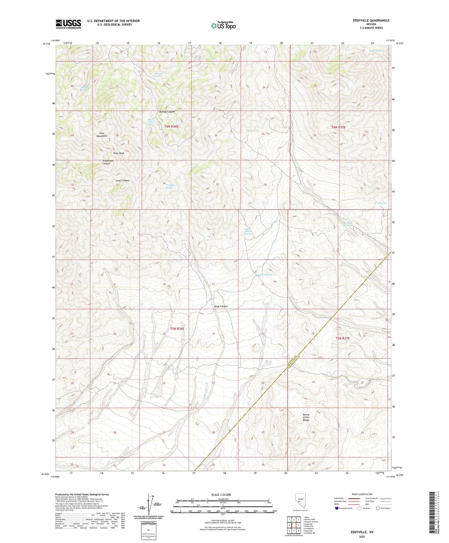
2021 topographic map quadrangle Eddyville in the state of Nevada. Scale: 1:24000. Based on the newly updated USGS 7.5' US Topo map series, this map is in the following counties: Mineral, Esmeralda. The map contains contour data, water features, and other items you are used to seeing on USGS maps, but also has updated roads and other features. This is the next generation of topographic maps. Printed on high-quality waterproof paper with UV fade-resistant inks.
Quads adjacent to this one:
West: Sodaville
Northwest: Mina
North: Bettles Well
Northeast: Dicalite Summit
East: Kibby Flat
Southeast: Coaldale NE
South: Rock Hill
Southwest: Candelaria
Contains the following named places: Allen Mine, Belleville Mine, Betty Mine, Betty Spring, Blue Link Spring, Cardinal Mine, Cornelius Spring, Dunlap Mine, Dunlap Tunnel Spring, Eddyville, Graham Spring, Hasbrouck Mine, Hitt Mine, Inman Mine, Lost Steers Mine, Mina Mine, Mosier Mine, Mustang Spring, Pilot Mountains, Pilot Peak, Reward Mine, Sullivan Mine, Summit Spring, Troy Spring, Upper Summit Spring, Warlock Mine, Warlock Spring, Wide Canyon