MyTopo
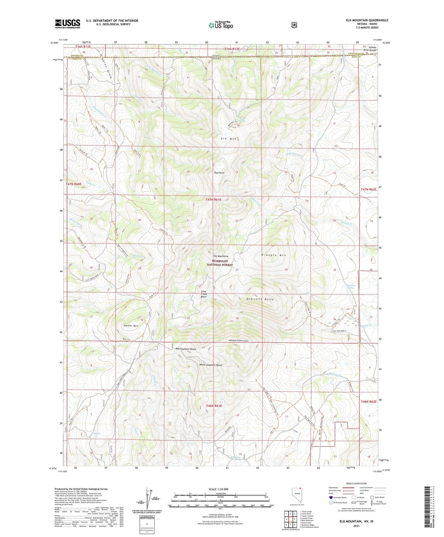
Elk Mountain Nevada US Topo Map
Couldn't load pickup availability
Also explore the Elk Mountain Forest Service Topo of this same quad for updated USFS data
2021 topographic map quadrangle Elk Mountain in the state of Nevada. Scale: 1:24000. Based on the newly updated USGS 7.5' US Topo map series, this map is in the following counties: Elko, Owyhee, Twin Falls. The map contains contour data, water features, and other items you are used to seeing on USGS maps, but also has updated roads and other features. This is the next generation of topographic maps. Printed on high-quality waterproof paper with UV fade-resistant inks.
Quads adjacent to this one:
West: Caudle Creek
Northwest: Three Creek
North: Curtis Draw
Northeast: Taylor Canyon
East: Bear Mountain
Southeast: Twin Meadows Ranch
South: Buckhorn Ridge
Southwest: Goat Creek
This map covers the same area as the classic USGS quad with code o41115h1.
Contains the following named places: Axe Handle Creek, Bull Camp, Bull Camp Spring, Chicken Spring, Elk Mountain, Elk Mountain Mining District, Elk Mountains, H Spring, Lime Creek Basin, Mahogany Elephant Butte, North Creek, Owens Mountain, Quartzite Butte, Red Elephant Butte, Red Point, Sagehen Spring, White Elephant Butte, Wrangle Mountain