MyTopo
Ely Nevada US Topo Map
Couldn't load pickup availability
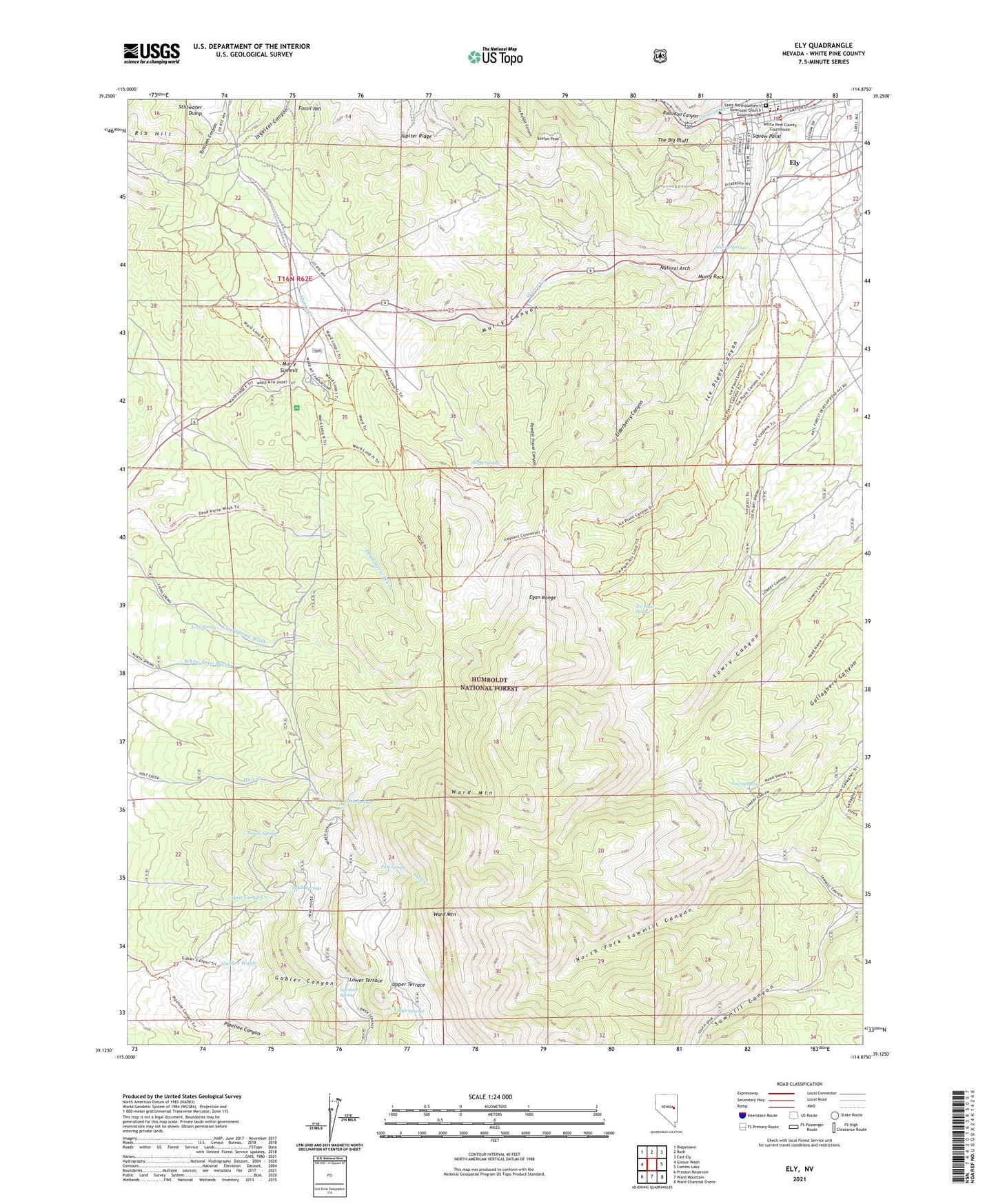
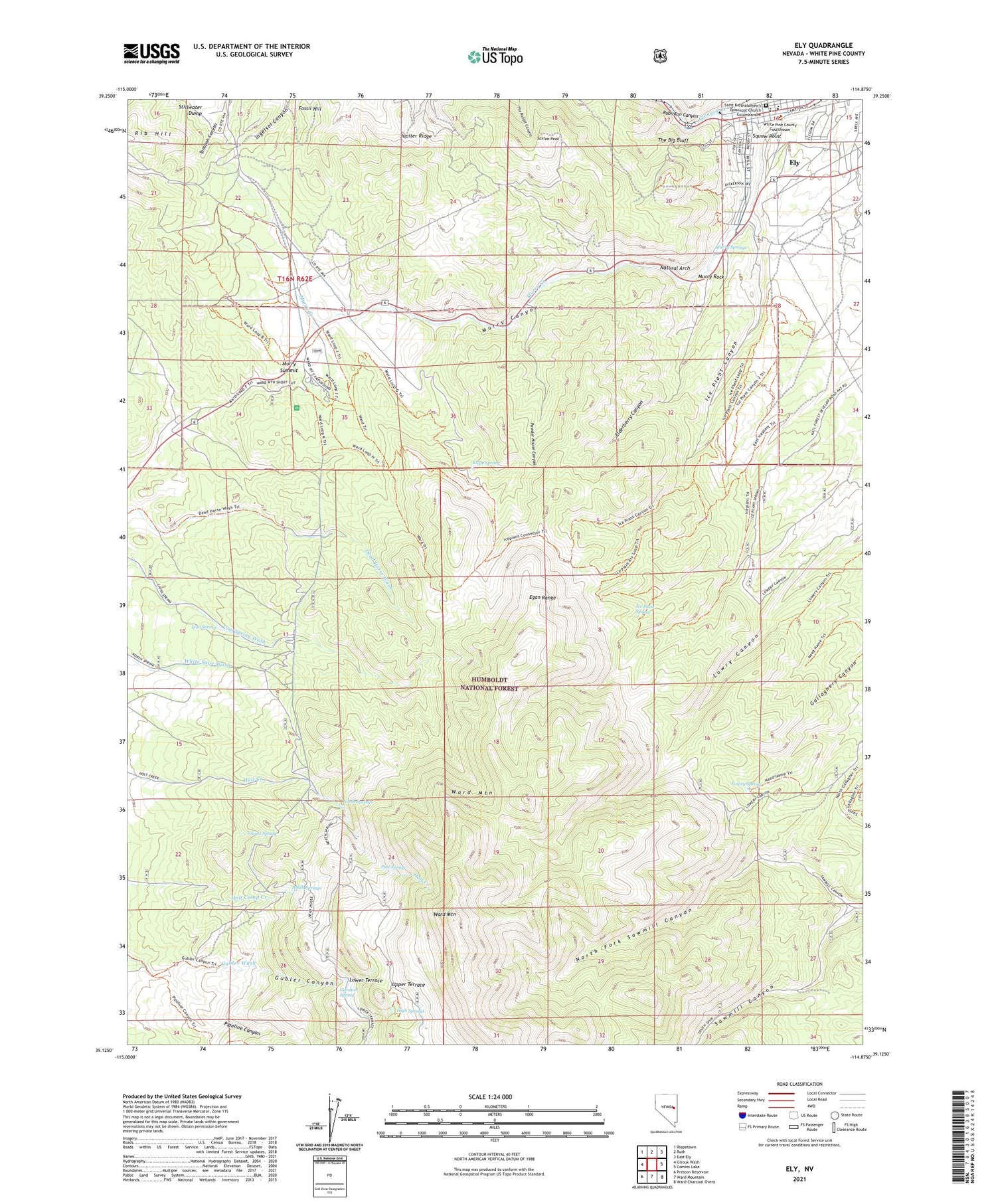
2021 topographic map quadrangle Ely in the state of Nevada. Scale: 1:24000. Based on the newly updated USGS 7.5' US Topo map series, this map is in the following counties: White Pine. The map contains contour data, water features, and other items you are used to seeing on USGS maps, but also has updated roads and other features. This is the next generation of topographic maps. Printed on high-quality waterproof paper with UV fade-resistant inks.
Quads adjacent to this one:
West: Giroux Wash
Northwest: Riepetown
North: Ruth
Northeast: East Ely
East: Comins Lake
Southeast: Ward Charcoal Ovens
South: Ward Mountain
Southwest: Preston Reservoir
Contains the following named places: Bell Shaft, Black Spot Mine, Bristlecone Convention Center, Elderberry Canyon, Ely, Ely City Hall, Ely Indian Reservation, Ely Junction, Farnsworth-Ely Metal Mine, Fossil Hill, Gardner Spring, Gleason Creek, Gubler Canyon, High Springs, Ice Plant Canyon, Ice Plant Number One Dam, Ice Plant Spring, KBXS-FM (Ely), Kellinske Shaft, Kelly-Leach Mine, Landmark Letters, Lion Spring, Lowry Spring, Minoletti Shaft, Murry Canyon, Murry Rock, Murry Springs, Murry Street School, Murry Summit, Natural Arch, North Fork Sawmill Canyon, North Springs, Pine Spring, Pipeline Canyon, Powder House Canyon, Quincy Mine, Riepe Spring, Robinson Canyon, Sacred Heart Elementary School, Saxton Peak, South Springs, Squaw Point, Steptoe Valley High School, The Big Bluff, Tonopah Canyon, Tunnel Spring, Ward Mountain Recreation Area, Ward Mountain Ski Hill, White Pine County Courthouse, White Pine County Emergency Medical Services - Ely, White Pine County Library, White Pine County Offices, White Pine Middle School