MyTopo
Eureka Nevada US Topo Map
Couldn't load pickup availability
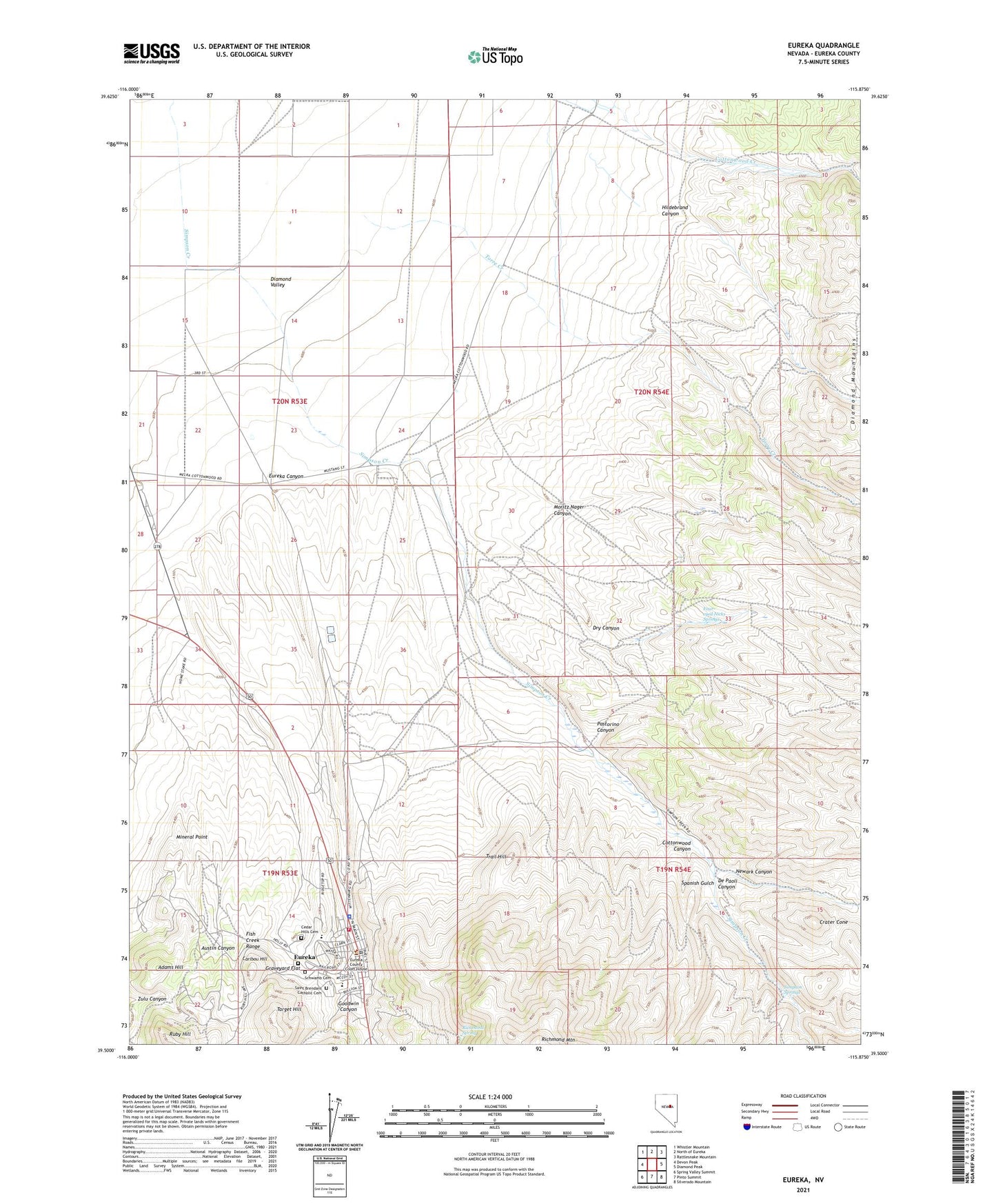
2021 topographic map quadrangle Eureka in the state of Nevada. Scale: 1:24000. Based on the newly updated USGS 7.5' US Topo map series, this map is in the following counties: Eureka. The map contains contour data, water features, and other items you are used to seeing on USGS maps, but also has updated roads and other features. This is the next generation of topographic maps. Printed on high-quality waterproof paper with UV fade-resistant inks.
Quads adjacent to this one:
West: Devon Peak
Northwest: Whistler Mountain
North: North of Eureka
Northeast: Rattlesnake Mountain
East: Diamond Peak
Southeast: Silverado Mountain
South: Pinto Summit
Southwest: Spring Valley Summit
Contains the following named places: Adams Hill, Albion Shaft, Atlas Works Mill, Austin Canyon, Bank Ranch, Bell Shaft, Bowman Shaft, Bullwhacker Mine, Caribou Hill, Cedar Hills Cemetery, Cherry Creek, Colman, Cottonwood Canyon, Crater Cone, Credo Shaft, Cyanide Shaft, De Paoli Canyon, Dry Canyon, Eunice Place, Eureka, Eureka Canyon, Eureka Census Designated Place, Eureka Consolidated Mine, Eureka Consolidated New Shaft, Eureka Consolidated Works Mill, Eureka County Sheriff's Office, Eureka Elementary School, Eureka High School, Eureka Masonic Cemetery, Eureka Post Office, Eureka Station, Eureka Volunteer Ambulance Service, Eureka Volunteer Fire Department, Fad Shaft, Four-eyed Nicks Springs, Goodwin Canyon, Granite Tunnel, Graveyard Flat, Great Basin College Eureka Satellite Center, Helen Shaft, Hildebrand Canyon, Holly Extension Shaft, Holly Shaft, Hunters Ranch, Jackson Mine, K K Consolidated Mine, K K Mine, LaBarry Ranch, Locan Shaft, Mineral Point, Moritz Nager Canyon, Newark Canyon, Palmer Ranch, Pastorino Canyon, Richmond Mining Company Mine, Richmond Mountain, Richmond Shaft, Richmond Spring, Ruby Hill, Ruby Hill Post Office, Saint Brendans Catholic Cemetery, Sandula Shaft, Sawmill Creek, Schwamb Cemetery, Simpson Springs, Spanish Gulch, T L Shaft, Target Hill, The Willows, Trail Hill, Wide West Mine, Williamsburg Mine