MyTopo
Devon Peak Nevada US Topo Map
Couldn't load pickup availability
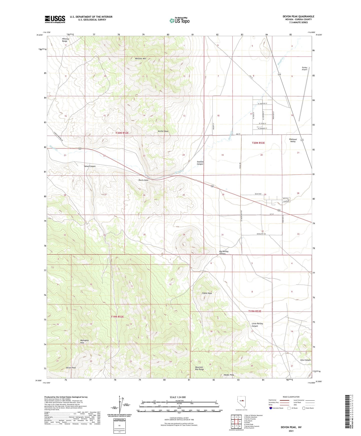
2021 topographic map quadrangle Devon Peak in the state of Nevada. Scale: 1:24000. Based on the newly updated USGS 7.5' US Topo map series, this map is in the following counties: Eureka. The map contains contour data, water features, and other items you are used to seeing on USGS maps, but also has updated roads and other features. This is the next generation of topographic maps. Printed on high-quality waterproof paper with UV fade-resistant inks.
Quads adjacent to this one:
West: Hay Ranch
Northwest: West of Whistler Mountain
North: Whistler Mountain
Northeast: North of Eureka
East: Eureka
Southeast: Pinto Summit
South: Spring Valley Summit
Southwest: Combs Peak
This map covers the same area as the classic USGS quad with code o39116e1.
Contains the following named places: Anchor Peak, Big Reilley Canyon, Chance Mine, Devils Gate, Devon Peak, Eureka Airport, Eureka Township, Little Reilley Canyon, Modoc Peak, Price and Davis Mine, Signal Peak, Silver Lick Mine, Spring Valley Mining District, Swallow Canyon, Wales Mine, Yahoo Canyon, Zulu Canyon