MyTopo
Exchequer Spring Nevada US Topo Map
Couldn't load pickup availability
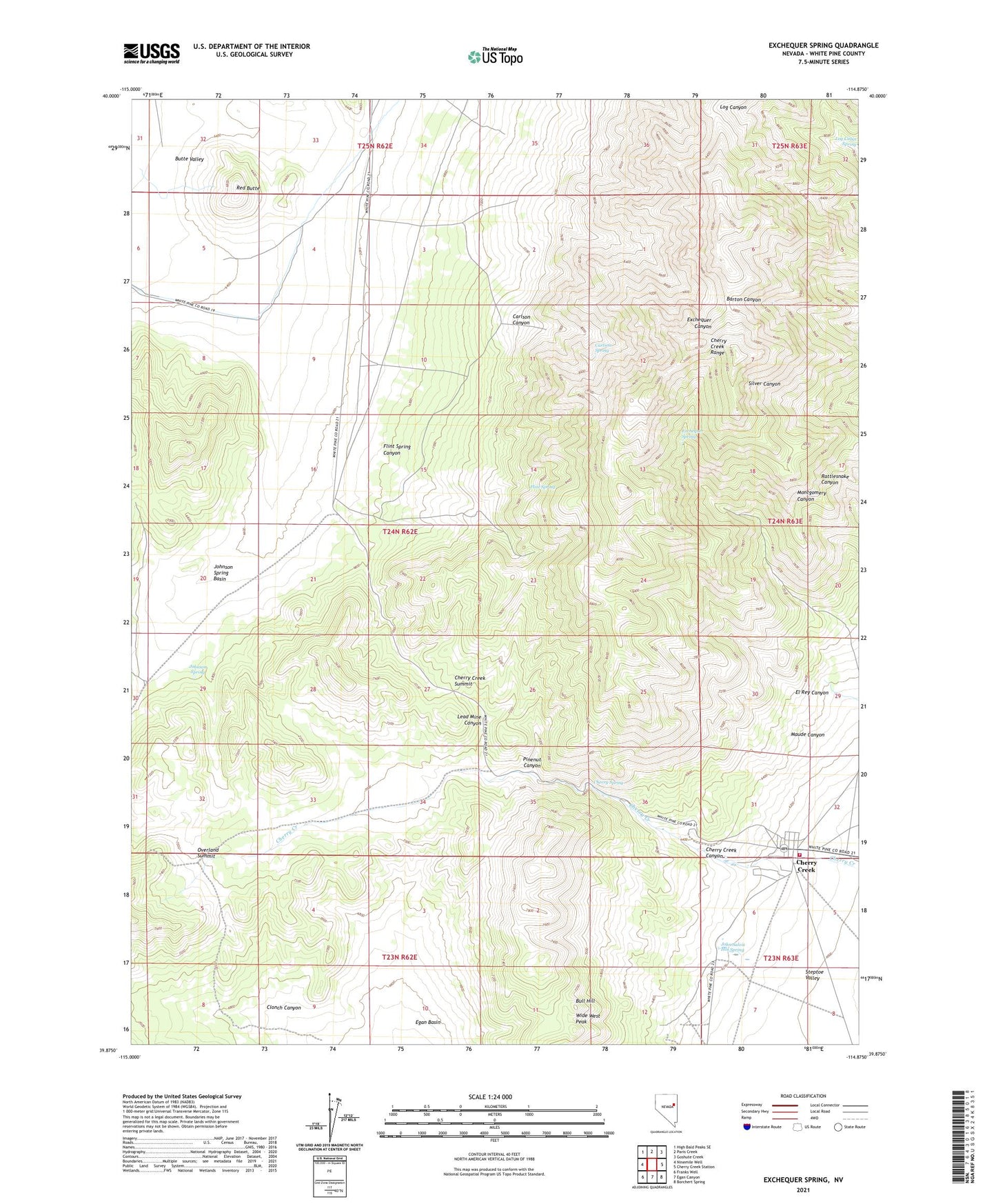
2021 topographic map quadrangle Exchequer Spring in the state of Nevada. Scale: 1:24000. Based on the newly updated USGS 7.5' US Topo map series, this map is in the following counties: White Pine. The map contains contour data, water features, and other items you are used to seeing on USGS maps, but also has updated roads and other features. This is the next generation of topographic maps. Printed on high-quality waterproof paper with UV fade-resistant inks.
Quads adjacent to this one:
West: Ninemile Well
Northwest: High Bald Peaks SE
North: Paris Creek
Northeast: Goshute Creek
East: Cherry Creek Station
Southeast: Borchert Spring
South: Egan Canyon
Southwest: Franks Well
Contains the following named places: Bluebell Mine, Bull Hill, Bull Hill Mine, Calcite Mine, Carlson Canyon, Carlson Spring, Chance Mine, Cherry Creek, Cherry Creek Canyon, Cherry Creek Mining District, Cherry Creek Post Office, Cherry Creek Summit, Cherry Spring, Clonch Canyon, Egan Basin Well, El Rey Canyon, Exchequer Mine, Exchequer Spring, Fera Fortysix, Fillmore Mine, Flint Spring, Flint Spring Canyon, Geneva Mine, Gray Eagle Mine, Happy Mine, John Salvis Hot Spring, Johnson Spring, Johnson Spring Basin, Last Chance Mine, Lead Mine Canyon, Madellina Ranch, Maryanne Mine, Maude Canyon, New Century Mine, Niptown, Old Timer Mine, Overland Summit, Pinenut Canyon, Red Butte, Salvi Ranch, Star Mine, Steptoe Valley Volunteer Fire Department, Teacup Mine, Uppertown, Wide West Peak