MyTopo
Cherry Creek Station Nevada US Topo Map
Couldn't load pickup availability
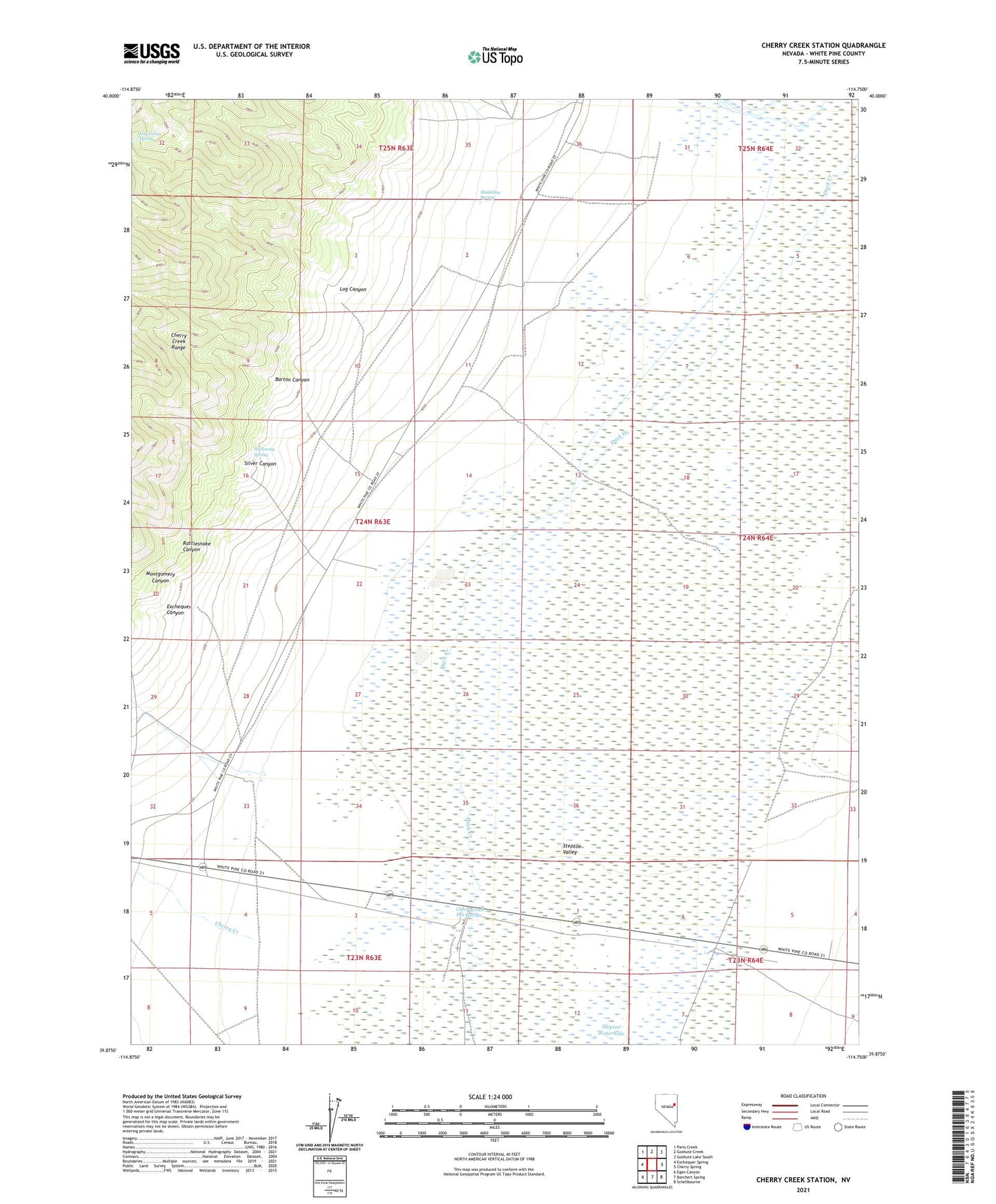
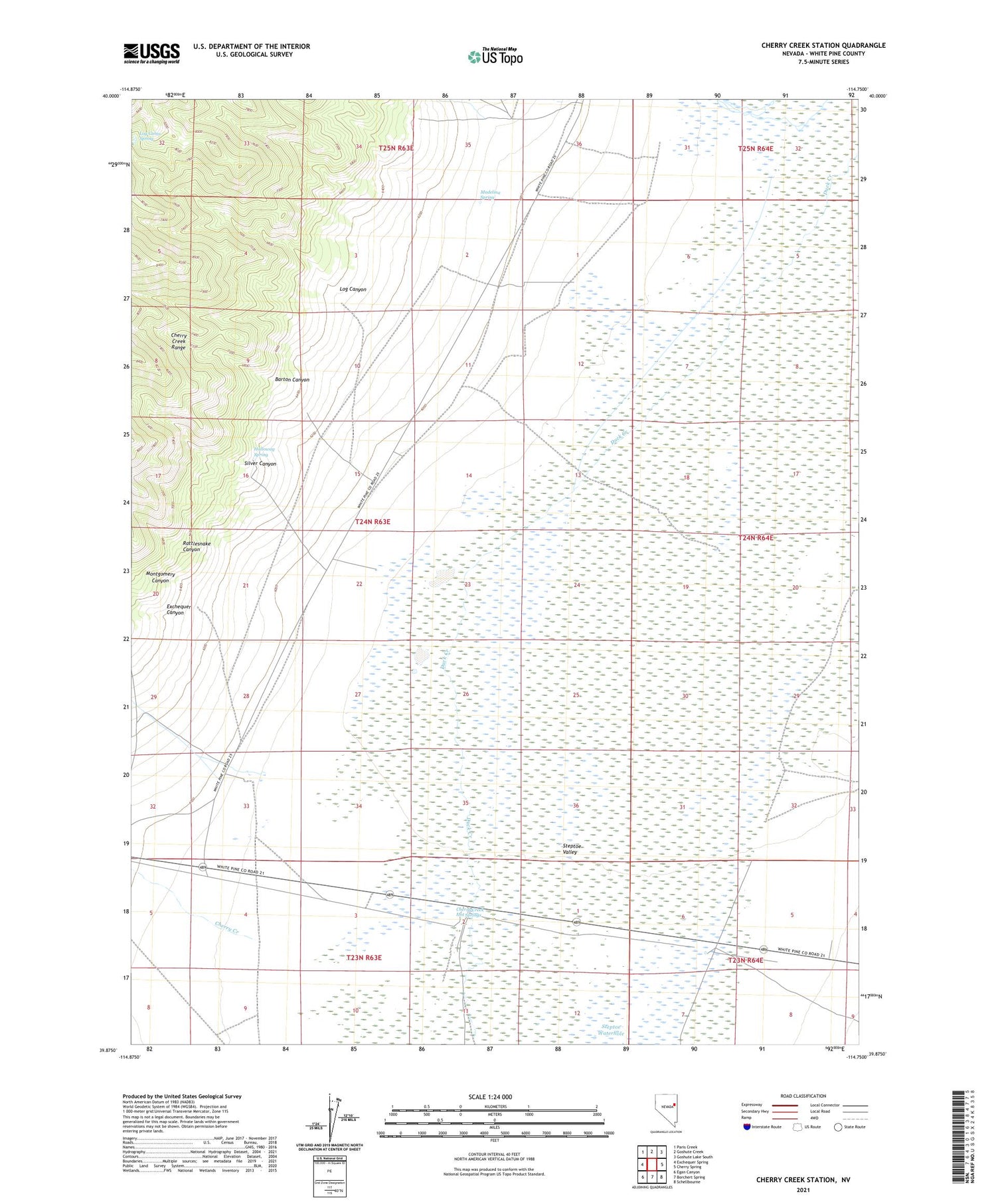
2021 topographic map quadrangle Cherry Creek Station in the state of Nevada. Scale: 1:24000. Based on the newly updated USGS 7.5' US Topo map series, this map is in the following counties: White Pine. The map contains contour data, water features, and other items you are used to seeing on USGS maps, but also has updated roads and other features. This is the next generation of topographic maps. Printed on high-quality waterproof paper with UV fade-resistant inks.
Quads adjacent to this one:
West: Exchequer Spring
Northwest: Paris Creek
North: Goshute Creek
Northeast: Goshute Lake South
East: Cherry Spring
Southeast: Schellbourne
South: Borchert Spring
Southwest: Egan Canyon
This map covers the same area as the classic USGS quad with code o39114h7.
Contains the following named places: Barton Canyon, Black Metal Mine, Cherry Creek, Cherry Creek Hot Springs, Cherry Creek Station, Exchequer Canyon, Foppiano Ranch, Gypsy Mine, Halloway Spring, Log Cabin Spring, Log Canyon, Madelina Spring, Montgomery Canyon, Rattlesnake Canyon, Silver Canyon, Social Company Mill, Spring Gulch Well, Steptoe Waterhole