MyTopo
Steamboat Nevada US Topo Map
Couldn't load pickup availability
Also explore the Steamboat Forest Service Topo of this same quad for updated USFS data
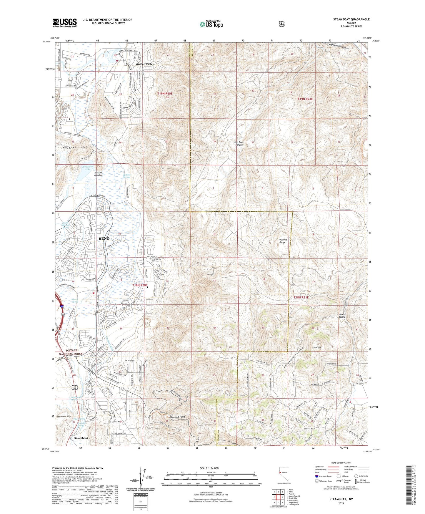
2021 topographic map quadrangle Steamboat in the state of Nevada. Scale: 1:24000. Based on the newly updated USGS 7.5' US Topo map series, this map is in the following counties: Washoe, Storey. The map contains contour data, water features, and other items you are used to seeing on USGS maps, but also has updated roads and other features. This is the next generation of topographic maps. Printed on high-quality waterproof paper with UV fade-resistant inks.
Quads adjacent to this one:
West: Mount Rose NE
Northwest: Reno
North: Vista
Northeast: Patrick
East: Chalk Hills
Southeast: Flowery Peak
South: Virginia City
Southwest: Washoe City
This map covers the same area as the classic USGS quad with code o39119d6.
Contains the following named places: Alexander Lake, Alum Spring, Bella Vista Ranch, Bianco Ranch, Boynton Slough, Brown Elementary School, Caldwell Ravine, Carver Well, Castle Peak, Castle Peak Mine, Castle Peak Mining District, Chandler Ditch, Crane Ditch, Damonte Ranch High School, Damonte Ranch Middle School, Davidson Well, Dimonte Spring, Donner Springs Elementary School, Double Diamond Elementary School, Double Diamond Spring, Double Diamond Well, East Reno Well, Frazier Well, Geiger Lookout Wayside Park, Harold Herz Wells, Hidden Valley, Hidden Valley County Park, Hidden Valley Volunteer Fire Department, Huffaker Springs, Isbell Well, Johnson Well, KHIT-AM (Sun Valley), Kids R Kids Kindergarten, KJOR-AM (Reno), Knox Well, LeCroix Well, Lighthouse Baptist Academy, Lookout Point, Lousetown, Magnolia House, McComas Well, McKnight Well, Miraloma Park Shopping Center, Mount Rose 1 Well, Ponderosa Ranch, Rancho Mira Loma, Red Rock Canyon, Reno Fire Department Station 12, Reno Hot Springs, Reno Southeast Division, Reno Well, Rodeo Well, Sage Hill Gun Club, Senges Well, South Steamboat Well, Southeast Truckee Meadows Division, Star Grange Hall, Steamboat, Steamboat 4 Well, Steamboat Springs, Storey County Fire Department Station 2 Virginia Highlands, Sutherland Well, Treps Farm, Virginia City Highlands, Warren Well, Washington, Washington Hill Prospect, Washington Mining District, West Reno Well, Whites Creek, ZIP Codes: 89502, 89521