MyTopo
Fortynine Mountain Nevada US Topo Map
Couldn't load pickup availability
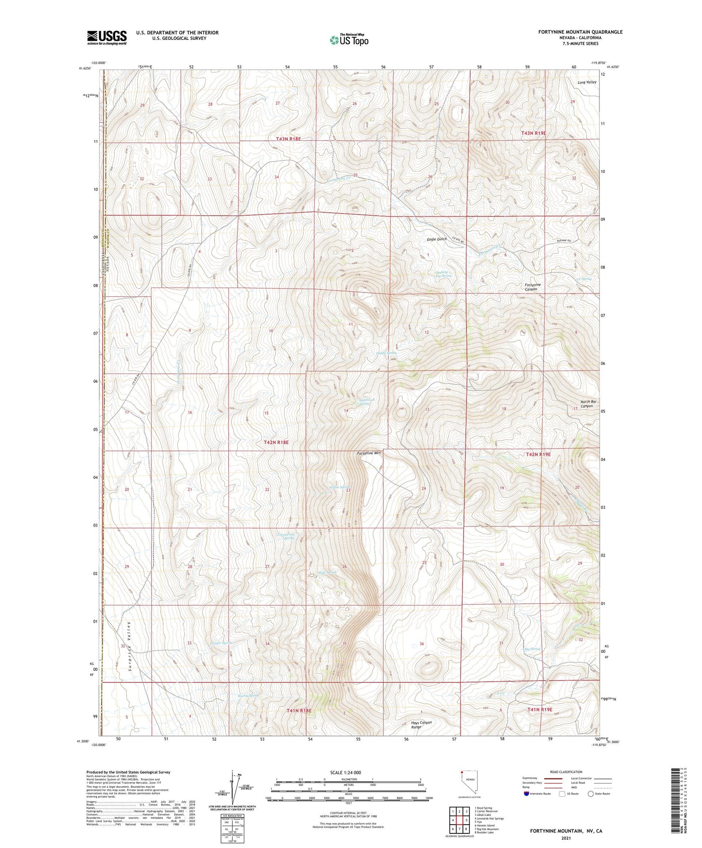
2021 topographic map quadrangle Fortynine Mountain in the state of Nevada. Scale: 1:24000. Based on the newly updated USGS 7.5' US Topo map series, this map is in the following counties: Washoe, Modoc. The map contains contour data, water features, and other items you are used to seeing on USGS maps, but also has updated roads and other features. This is the next generation of topographic maps. Printed on high-quality waterproof paper with UV fade-resistant inks.
Quads adjacent to this one:
West: Leonards Hot Springs
Northwest: Boyd Spring
North: Carter Reservoir
Northeast: Alkali Lake
East: Vya
Southeast: Boulder Lake
South: Big Hat Mountain
Southwest: Hansen Island
This map covers the same area as the classic USGS quad with code o41119e8.
Contains the following named places: Big Spring, CC Spring, Cottonwood Spring, Eagle Gulch, Farmer Spring, Fortynine Camp, Fortynine Mountain, Fortynine Ranch, Koenig Spring, Quaking Asp Spring, Saddle Spring, Sagebrush Spring, Slide Spring, Willow Spring