MyTopo
Hansen Island California US Topo Map
Couldn't load pickup availability
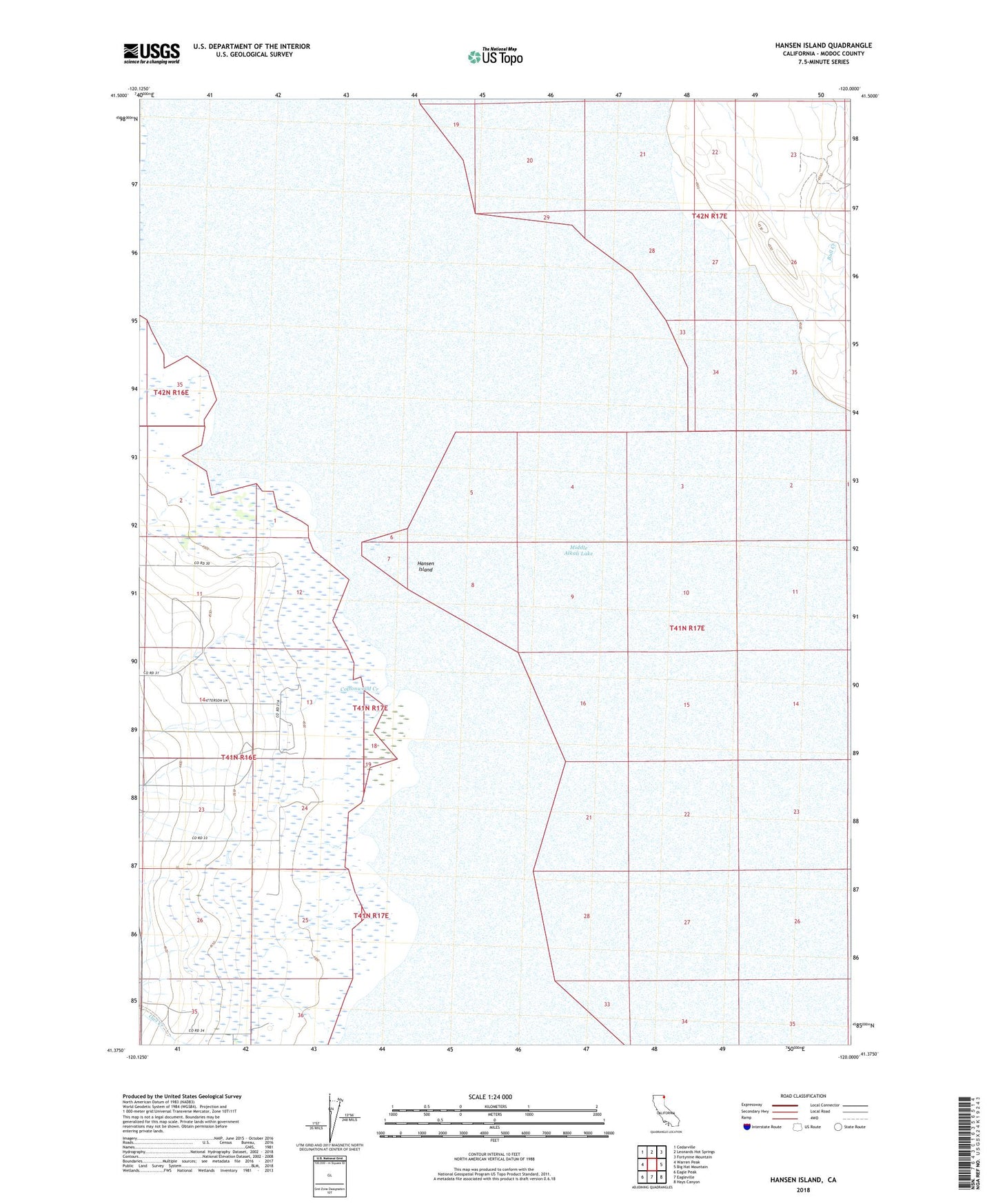
2021 topographic map quadrangle Hansen Island in the state of California. Scale: 1:24000. Based on the newly updated USGS 7.5' US Topo map series, this map is in the following counties: Modoc. The map contains contour data, water features, and other items you are used to seeing on USGS maps, but also has updated roads and other features. This is the next generation of topographic maps. Printed on high-quality waterproof paper with UV fade-resistant inks.
Quads adjacent to this one:
West: Warren Peak
Northwest: Cedarville
North: Leonards Hot Springs
Northeast: Fortynine Mountain
East: Big Hat Mountain
Southeast: Hays Canyon
South: Eagleville
Southwest: Eagle Peak
This map covers the same area as the classic USGS quad with code o41120d1.
Contains the following named places: Bull Creek, Cottonwood Creek, Fortynine Creek, Hansen Island, Little Cottonwood Creek, Middle Alkali Lake, Steamboat Creek