MyTopo
Leonards Hot Springs California US Topo Map
Couldn't load pickup availability
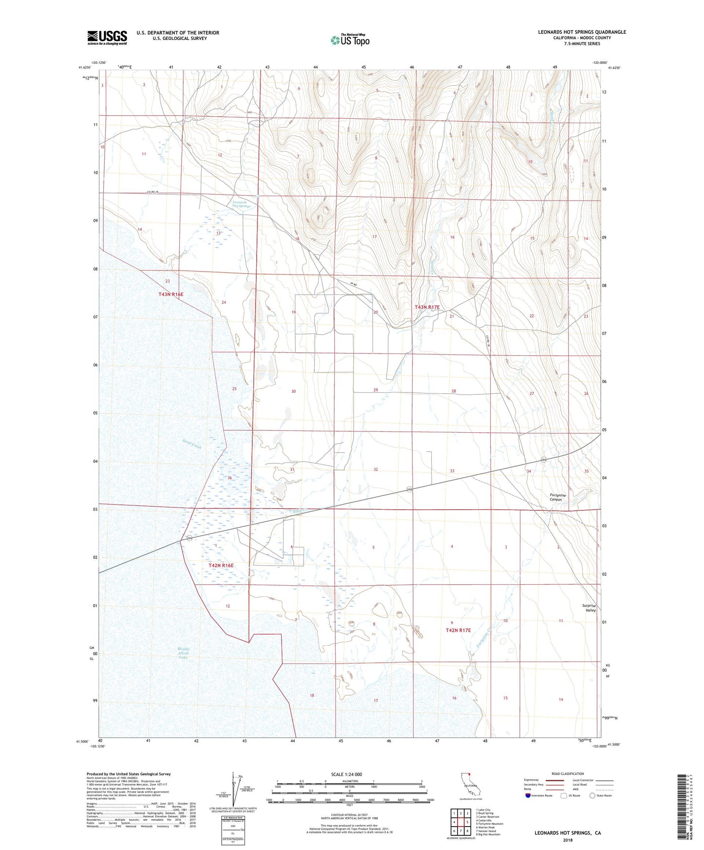
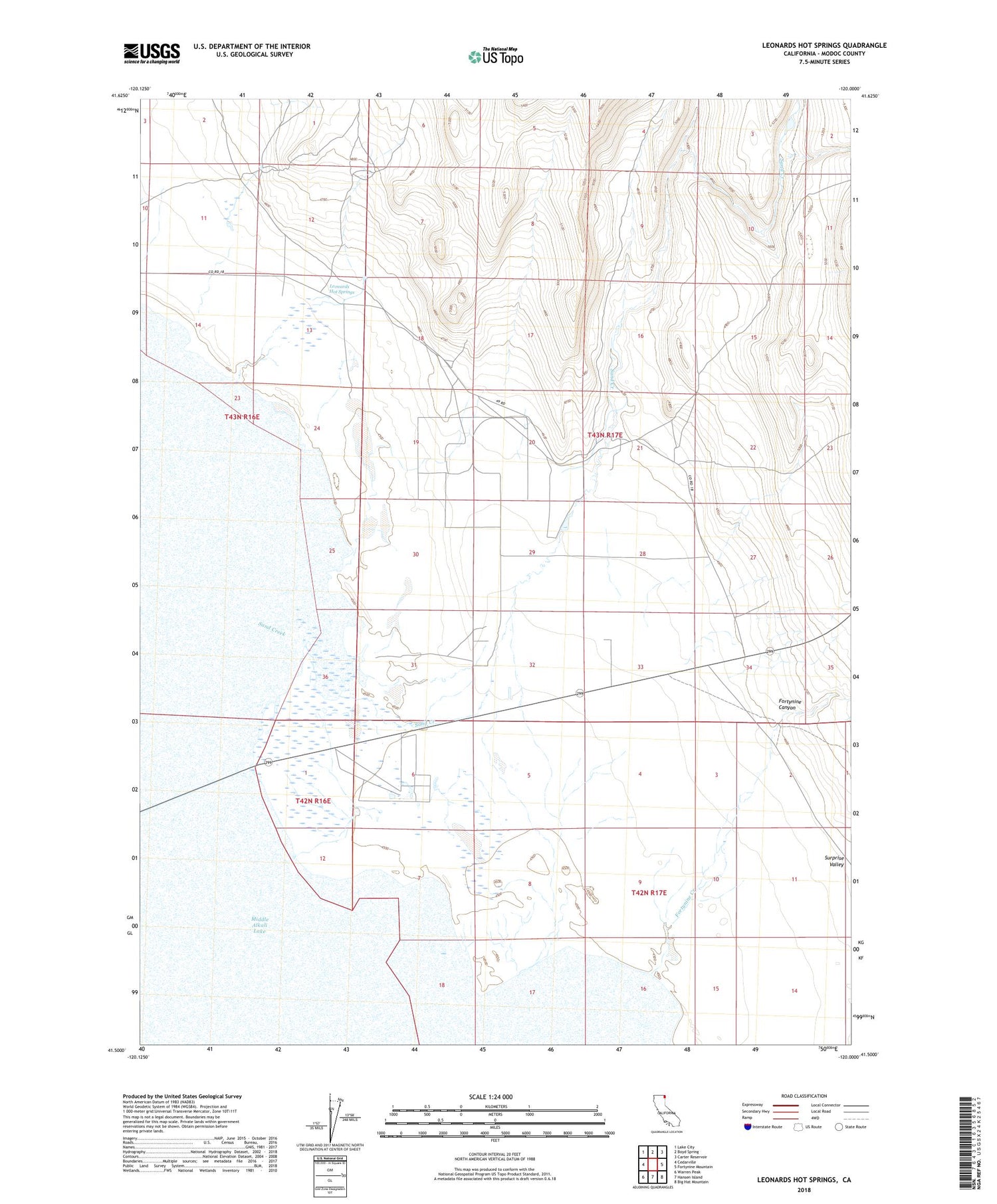
2021 topographic map quadrangle Leonards Hot Springs in the state of California. Scale: 1:24000. Based on the newly updated USGS 7.5' US Topo map series, this map is in the following counties: Modoc. The map contains contour data, water features, and other items you are used to seeing on USGS maps, but also has updated roads and other features. This is the next generation of topographic maps. Printed on high-quality waterproof paper with UV fade-resistant inks.
Quads adjacent to this one:
West: Cedarville
Northwest: Lake City
North: Boyd Spring
Northeast: Carter Reservoir
East: Fortynine Mountain
Southeast: Big Hat Mountain
South: Hansen Island
Southwest: Warren Peak
This map covers the same area as the classic USGS quad with code o41120e1.
Contains the following named places: Fortynine Canyon, Leonards Hot Springs, Sand Creek, Surprise Valley Division, Surprise Valley Mineral Wells