MyTopo
Gabbs Nevada US Topo Map
Couldn't load pickup availability
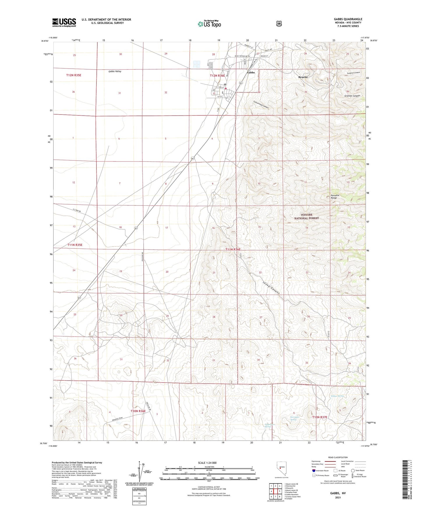
2021 topographic map quadrangle Gabbs in the state of Nevada. Scale: 1:24000. Based on the newly updated USGS 7.5' US Topo map series, this map is in the following counties: Nye. The map contains contour data, water features, and other items you are used to seeing on USGS maps, but also has updated roads and other features. This is the next generation of topographic maps. Printed on high-quality waterproof paper with UV fade-resistant inks.
Quads adjacent to this one:
West: Mount Annie SE
Northwest: Mount Annie NE
North: Downeyville
Northeast: Ellsworth
East: Paradise Peak
Southeast: Goldyke
South: Granny Goose Well
Southwest: Gabbs Mountain
Contains the following named places: Basic, Brucite, Brucite Mine, City of Gabbs, Cottontail Mine, Cottonwood Canyon, Davis Mine, Derringer Spring, Fairplay Mining District, Gabbs, Gabbs Census Designated Place, Gabbs City Hall, Gabbs Elementary School, Gabbs High School, Gabbs Middle School, Gabbs Post Office, Gabbs Township, Gabbs Volunteer Fire Department, Gold Ledge Mine, Gold Trace Mine, Granite Canyon, Kellys Wells, Lucky Strike Mine, Peppercorn Spring, Sheep Canyon, Sierra Mine, Sullivan Mine, Tungsten Canyon, Willow Spring