MyTopo
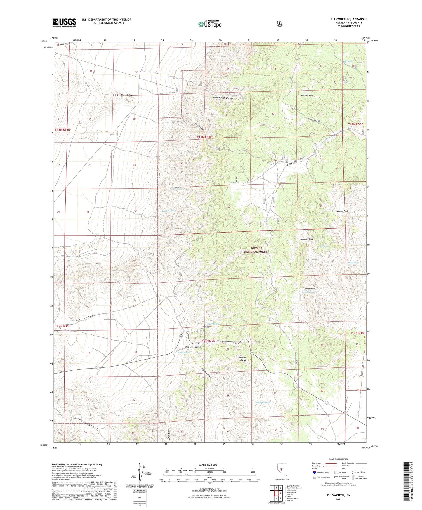
Ellsworth Nevada US Topo Map
Couldn't load pickup availability
Also explore the Ellsworth Forest Service Topo of this same quad for updated USFS data
2021 topographic map quadrangle Ellsworth in the state of Nevada. Scale: 1:24000. Based on the newly updated USGS 7.5' US Topo map series, this map is in the following counties: Nye. The map contains contour data, water features, and other items you are used to seeing on USGS maps, but also has updated roads and other features. This is the next generation of topographic maps. Printed on high-quality waterproof paper with UV fade-resistant inks.
Quads adjacent to this one:
West: Downeyville
Northwest: Quartz Mountain
North: Burnt Cabin Summit
Northeast: Midas Spring
East: Ione NW
Southeast: Ione SW
South: Paradise Peak
Southwest: Gabbs
This map covers the same area as the classic USGS quad with code o38117h7.
Contains the following named places: Bell Canyon, Big Chief Mine, Big Spring, Big Spring Mine, Camel Pass, Camel Spring, Chestnut Mine, Craig Station, Deer Spring, Eary Mine, Ellsworth, Ellsworth Mining District, Ellsworth Post Office, Ensle Dome Mine, Esta Buena Mine, Fairview Peak, Flagstaff Canyon, Fowler Spring, Gabbs Mining District, Germany Canyon, Green Spring, Green Springs, Green Springs Post Office, Lebeau Park, Lodi Tank, Lodi Tanks, Marble Falls, Marble Falls Canyon, Marsh Falls, Menter Canyon, Ottawa Spring, Paradise Range, Piute Mine, Return Mine, Rock Spring, Sherman Peak, Skunk Spring, Stokes Mine, Topier Canyon, Vindicator Mine