MyTopo
Orovada Nevada US Topo Map
Couldn't load pickup availability
Also explore the Orovada Forest Service Topo of this same quad for updated USFS data
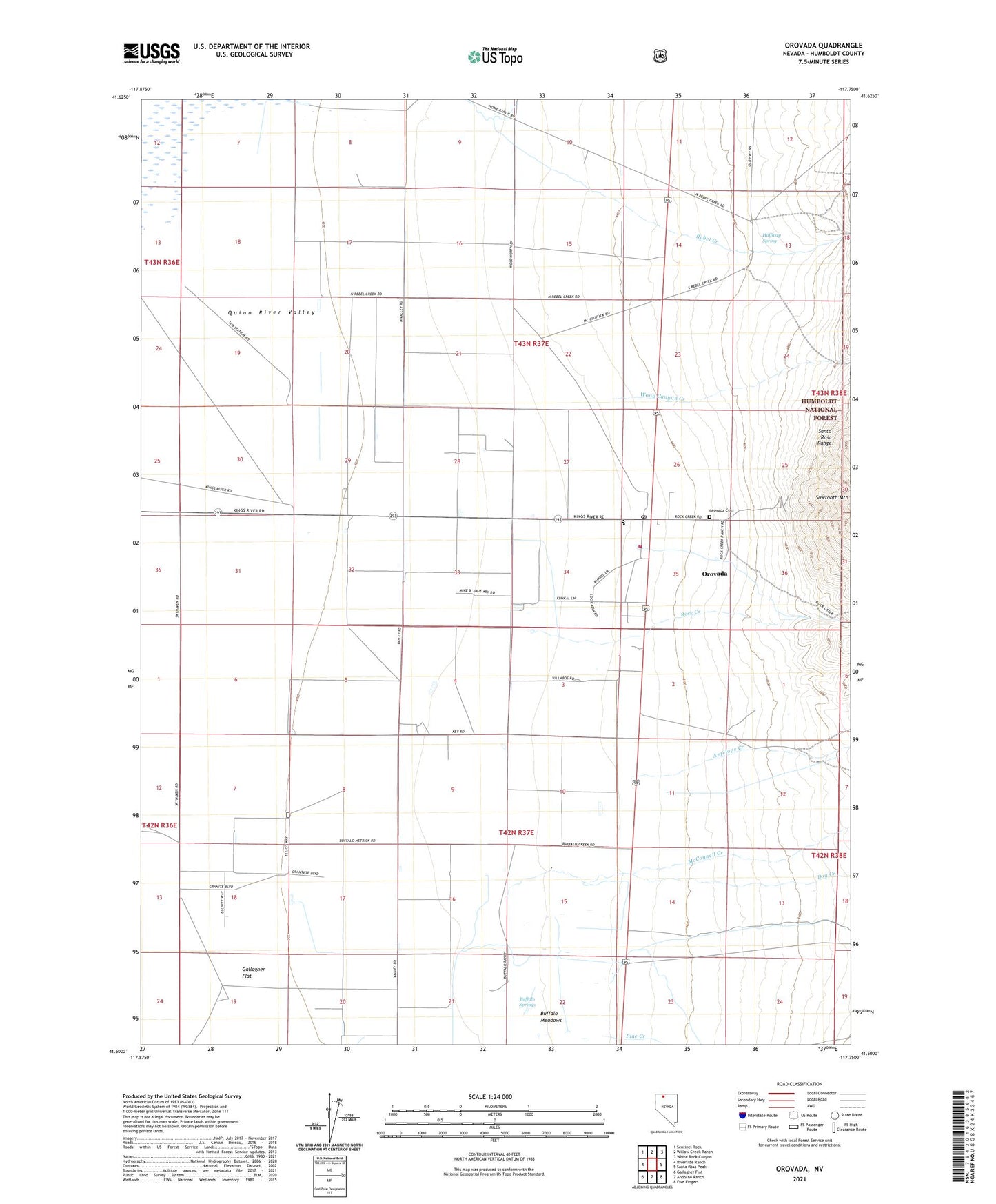
2021 topographic map quadrangle Orovada in the state of Nevada. Scale: 1:24000. Based on the newly updated USGS 7.5' US Topo map series, this map is in the following counties: Humboldt. The map contains contour data, water features, and other items you are used to seeing on USGS maps, but also has updated roads and other features. This is the next generation of topographic maps. Printed on high-quality waterproof paper with UV fade-resistant inks.
Quads adjacent to this one:
West: Riverside Ranch
Northwest: Sentinel Rock
North: Willow Creek Ranch
Northeast: White Rock Canyon
East: Santa Rosa Peak
Southeast: Five Fingers
South: Andorno Ranch
Southwest: Gallagher Flat
This map covers the same area as the classic USGS quad with code o41117e7.
Contains the following named places: Antelope Creek, Buffalo Creek, Buffalo Meadows, Buffalo Ranch, Buffalo Springs, Dog Creek, Golden Acres Ranch, Halfway Spring, McConnell Creek, Orovada, Orovada Cemetery, Orovada Census Designated Place, Orovada Elementary School, Orovada Fire Protection District, Orovada Post Office, Pine Creek, Pine Grove Airport, Rebel Creek, Rebel Creek Post Office, Rebel Creek Ranch, Rock Creek, Rock Creek Ranch, Wood Canyon Creek