MyTopo
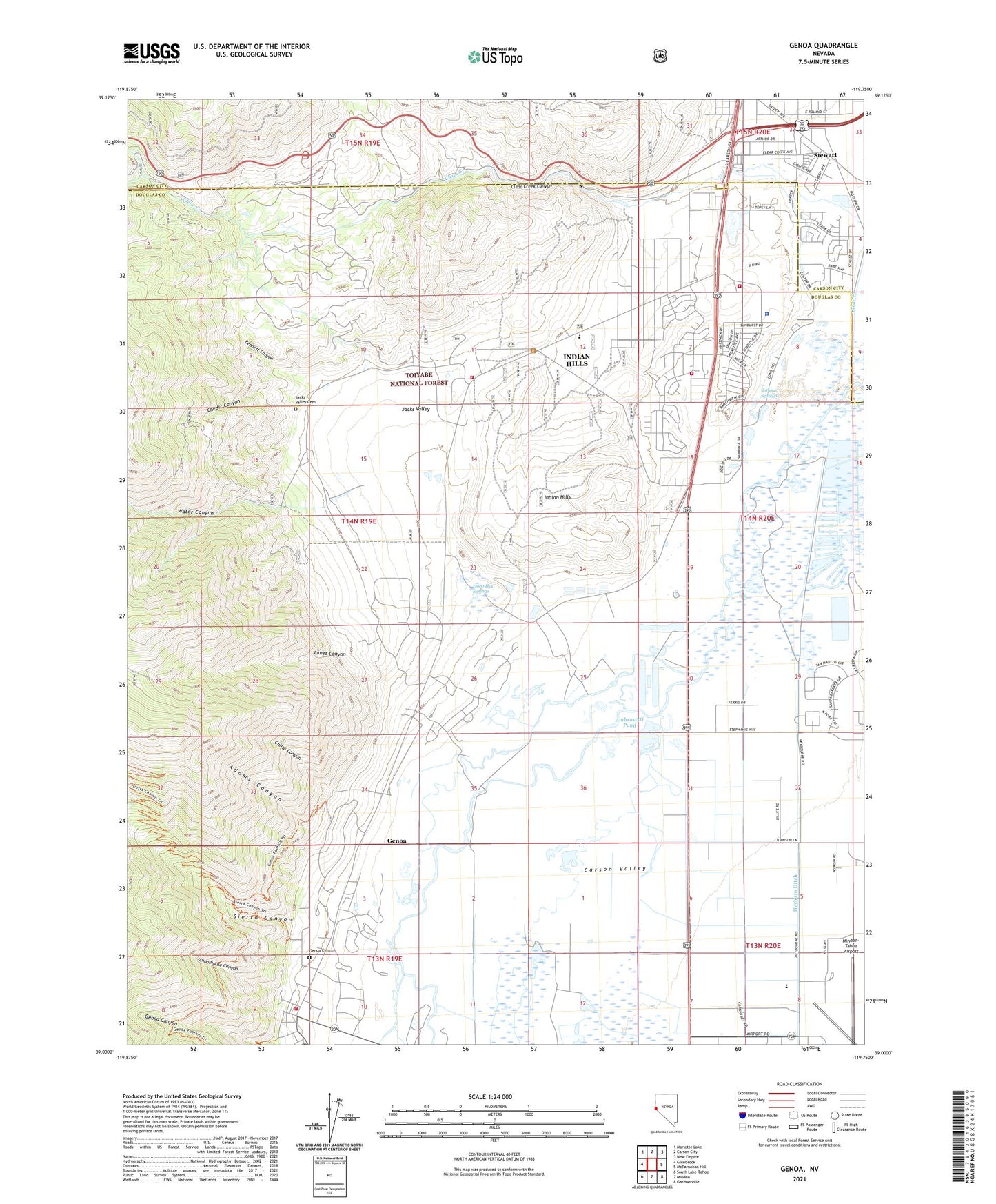
Genoa Nevada US Topo Map
Couldn't load pickup availability
2021 topographic map quadrangle Genoa in the state of Nevada. Scale: 1:24000. Based on the newly updated USGS 7.5' US Topo map series, this map is in the following counties: Douglas, Carson City (city). The map contains contour data, water features, and other items you are used to seeing on USGS maps, but also has updated roads and other features. This is the next generation of topographic maps. Printed on high-quality waterproof paper with UV fade-resistant inks.
Quads adjacent to this one:
West: Glenbrook
Northwest: Marlette Lake
North: Carson City
Northeast: New Empire
East: McTarnahan Hill
Southeast: Gardnerville
South: Minden
Southwest: South Lake Tahoe
Contains the following named places: Adams Canyon, Adams Ranch, Ambrosetti Pond, Barrett Mill, Bennett Canyon, Bridge House, Capital Christian School, Carson Valley, Chedic Canyon, Childs Canyon, Clear Creek Canyon, Clear Creek Station, Clear Creek Youth Center, Cook Ranch, Cradlebaugh, Cradlebaugh Bridge, Cradlebaugh Post Office, Douglas County Sheriff Substation, East Fork Fire and Paramedic Districts Station 12, East Fork Fire and Paramedic Districts Station 15 Jacks Valley Seasonal, East Fork Fire and Paramedic Districts Station 16, East Fork Fire and Paramedic Districts Station 3 Genoa Volunteer Fire Department, Fuji Park, Genoa, Genoa Canyon, Genoa Cemetery, Genoa Census Designated Place, Genoa Mining District, Genoa Station, Grace Christian Academy, Haskells Mill, Heyburn Ditch, Hobo Hot Springs, Hollister Ranch, Indian Hills, Indian Hills Census Designated Place, Jacks Valley, Jacks Valley Cemetery, Jacks Valley Elementary School, Jacks Valley Ranch, Jacks Valley Wildlife Management Area, James Canyon, James Canyon Ranch, Liberty Christian Academy, Minden Warehouse, Minden-Tahoe Airport, Mormon Station Historic State Monument, Old Mormon Station, Ormsby County Farm, Parker Airport, Rite of Passage, Schoolhouse Canyon, Sierra Canyon, Sierra Front Interagency Dispatch and Air Operations Center, Snyder Meadows State Park, Snyder Ranch, Stewart, Stewart Branch Post Office, Stewart Community, Stewart Indian School, Stewart Indian School Ranch, Sulphur Springs, Tahoe-Carson Speedway, Thornton, Tiedge Ranch, Water Canyon, Webster Hotel Station, Williams Slough, Winkleman Ranch, ZIP Codes: 89411, 89423, 89705