MyTopo
Glenbrook Nevada US Topo Map
Couldn't load pickup availability
Also explore the Glenbrook Forest Service Topo of this same quad for updated USFS data
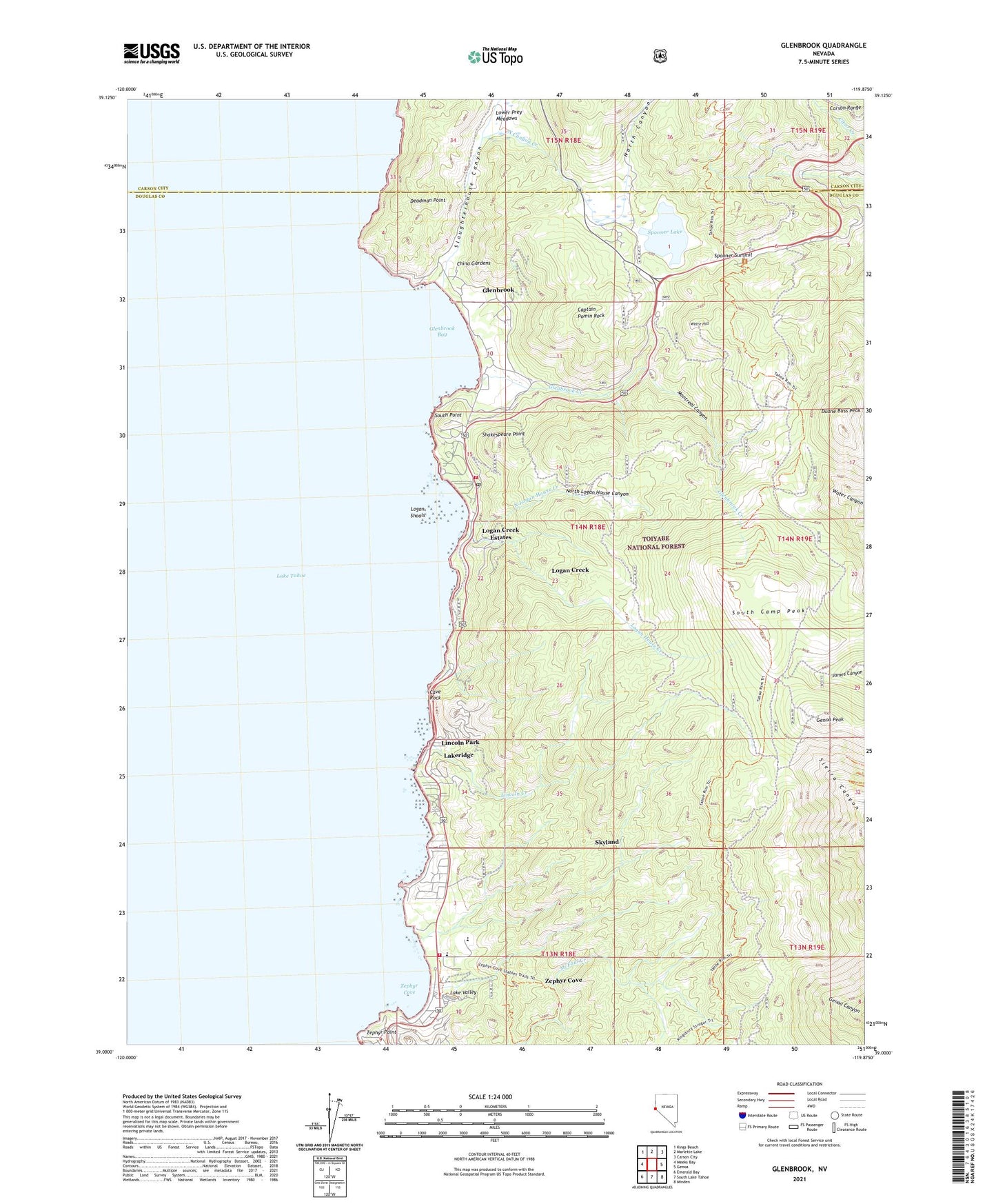
2021 topographic map quadrangle Glenbrook in the state of Nevada. Scale: 1:24000. Based on the newly updated USGS 7.5' US Topo map series, this map is in the following counties: Douglas, Carson City (city). The map contains contour data, water features, and other items you are used to seeing on USGS maps, but also has updated roads and other features. This is the next generation of topographic maps. Printed on high-quality waterproof paper with UV fade-resistant inks.
Quads adjacent to this one:
West: Meeks Bay
Northwest: Kings Beach
North: Marlette Lake
Northeast: Carson City
East: Genoa
Southeast: Minden
South: South Lake Tahoe
Southwest: Emerald Bay
This map covers the same area as the classic USGS quad with code o39119a8.
Contains the following named places: Camp Galilee, Captain Pomin Rock, Carson Ranger District, Cave Rock, China Gardens, Clear Creek Campground, Deadman Point, Duane Bliss Peak, Genoa Peak, George Whittell High School, Glenbrook, Glenbrook Bay, Glenbrook Census Designated Place, Glenbrook Creek, Glenbrook Golf Course, Glenbrook Nevada Division of Forestry, Glenbrook Post Office, Lake Bigler Lumber Company Sawmill, Lake Tahoe State Park Boat Ramp, Lake Valley, Lakeridge, Lakeridge Census Designated Place, Lincoln Creek, Lincoln Park, Logan Creek Census Designated Place, Logan Creek Estates, Logan House Creek, Logan Shoals, Logan Shoals Vista, Lower Prey Meadows, Montreal Canyon, North Canyon, North Canyon Creek, North Logan House Canyon, North Logan House Creek, Prison Honor Camp, Shakespeare Point, Skyland, Skyland Census Designated Place, Slaughterhouse Canyon, South Camp Peak, South Point, Spooner, Spooner Forest Service Facility, Spooner Junction, Spooner Lake, Spooner Lake Dam, Spooner Lake Management Area, Spooner Summit, Spooner Summit Recreation Site, Summit Camp, Tahoe Douglas Fire Protection District Station 4, Tahoe Douglas Fire Protection District Station 5, Tahoe School, White Hill, Zephyr Cove, Zephyr Cove Census Designated Place, Zephyr Cove Division, Zephyr Cove Elementary School, Zephyr Cove Nordic Center, Zephyr Cove-Round Hill Village Census Designated Place, Zephyr Point, ZIP Code: 89413