MyTopo
Marlette Lake Nevada US Topo Map
Couldn't load pickup availability
Also explore the Marlette Lake Forest Service Topo of this same quad for updated USFS data
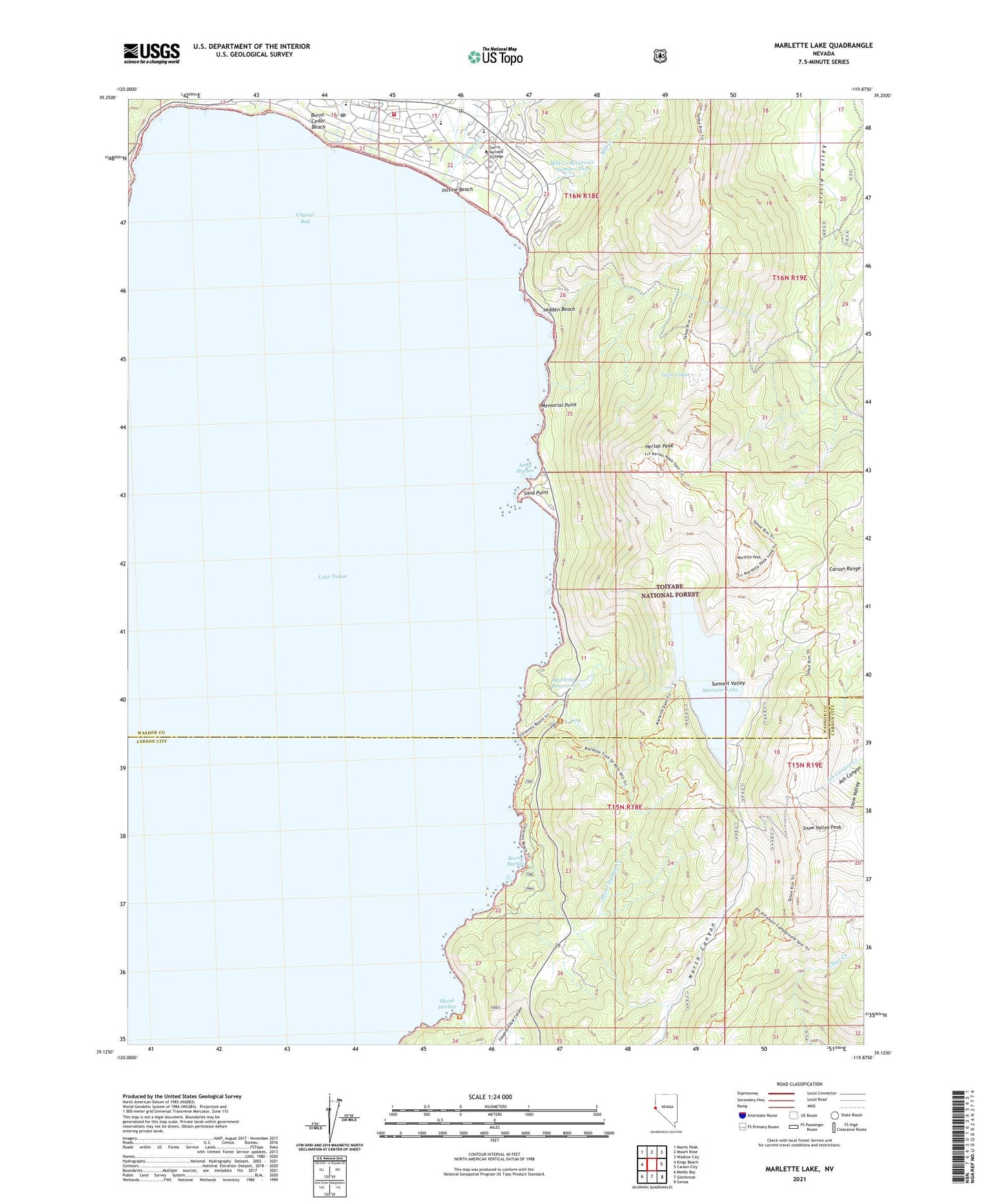
2021 topographic map quadrangle Marlette Lake in the state of Nevada. Scale: 1:24000. Based on the newly updated USGS 7.5' US Topo map series, this map is in the following counties: Washoe, Carson City (city). The map contains contour data, water features, and other items you are used to seeing on USGS maps, but also has updated roads and other features. This is the next generation of topographic maps. Printed on high-quality waterproof paper with UV fade-resistant inks.
Quads adjacent to this one:
West: Kings Beach
Northwest: Martis Peak
North: Mount Rose
Northeast: Washoe City
East: Carson City
Southeast: Genoa
South: Glenbrook
Southwest: Meeks Bay
This map covers the same area as the classic USGS quad with code o39119b8.
Contains the following named places: Backcountry Management Area, Bliss Creek, Burnt Cedar Beach, Crystal Bay, First Creek, Herlan Peak, Hidden Beach, Highway 28 Management Area, Incline Beach, Incline Creek, Incline Elementary K-2nd School, Incline Elementary School, Incline Guard Station, Incline Middle School, Incline Post Office, Incline Village Division, Incline Village Post Office, Incline Village-Crystal Bay Census Designated Place, Lake Tahoe School, Lake Tahoe State Park, Little Valley Mine, Mark Twain Cultural Center, Marlette Creek, Marlette Lake, Marlette Lake Dam, Marlette Peak, Marlette Reservoir, Memorial Point, Mill Creek, Mill Creek Dam Number Two, Mill Creek Reservoir Number Two, North Lake Tahoe Fire Protection District Station 11, Sand Harbor, Sand Harbor Beach State Recreation Area, Sand Point, Second Creek, Secret Harbor, Secret Harbor Creek, Skunk Harbor, Snow Valley Peak, Summit Valley, Third Creek, Tunnel Creek, Tunnel Creek Station, Twin Lakes, Village Shopping Center, ZIP Codes: 89450, 89451