MyTopo
Gold Park Nevada US Topo Map
Couldn't load pickup availability
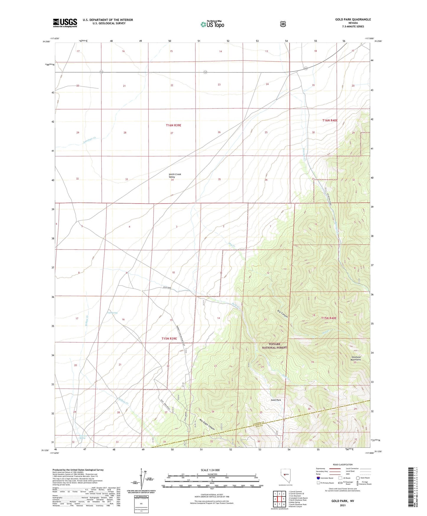
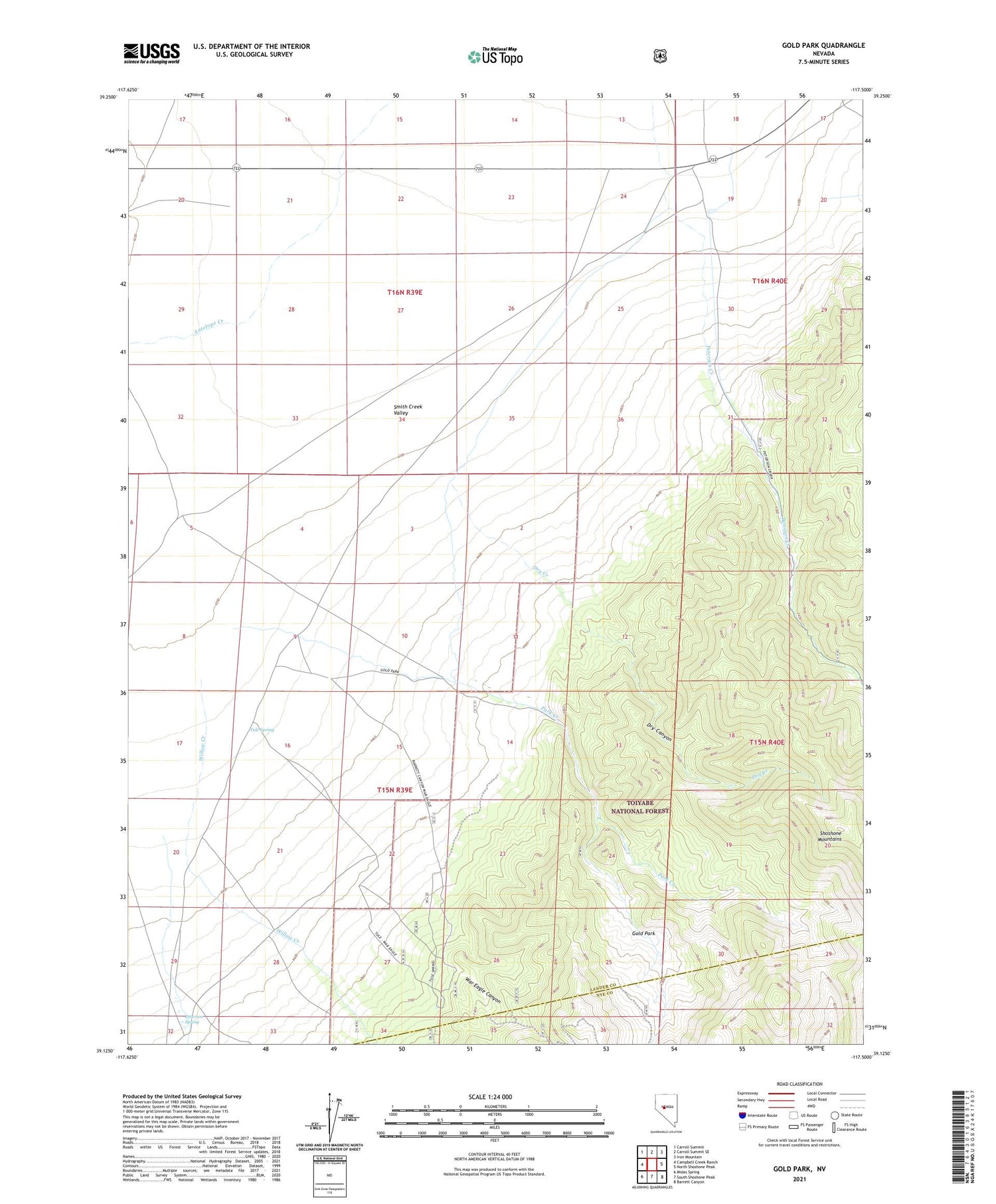
2021 topographic map quadrangle Gold Park in the state of Nevada. Scale: 1:24000. Based on the newly updated USGS 7.5' US Topo map series, this map is in the following counties: Lander, Nye. The map contains contour data, water features, and other items you are used to seeing on USGS maps, but also has updated roads and other features. This is the next generation of topographic maps. Printed on high-quality waterproof paper with UV fade-resistant inks.
Quads adjacent to this one:
West: Campbell Creek Ranch
Northwest: Carroll Summit
North: Carroll Summit SE
Northeast: Iron Mountain
East: North Shoshone Peak
Southeast: Barrett Canyon
South: South Shoshone Peak
Southwest: Midas Spring
Contains the following named places: Arctic Mine, Dry Canyon, Dry Creek, Gold Park, Gold Park Mine, Gold Park Post Office, Jackson Mining District, Lakeview, Lakeview Post Office, Park Creek, Peterson Creek, Peterson Maintenance Station, Peterson Mine, Peterson Spring, Peterson Station, Pilot, Pilot Basin Mine, Pilot Post Office, Rock Creek, San Francisco Mine, Star of the West Mine, Sunday Mine, Tule Spring, War Eagle Canyon, Willow Creek