MyTopo
Grantsville Nevada US Topo Map
Couldn't load pickup availability
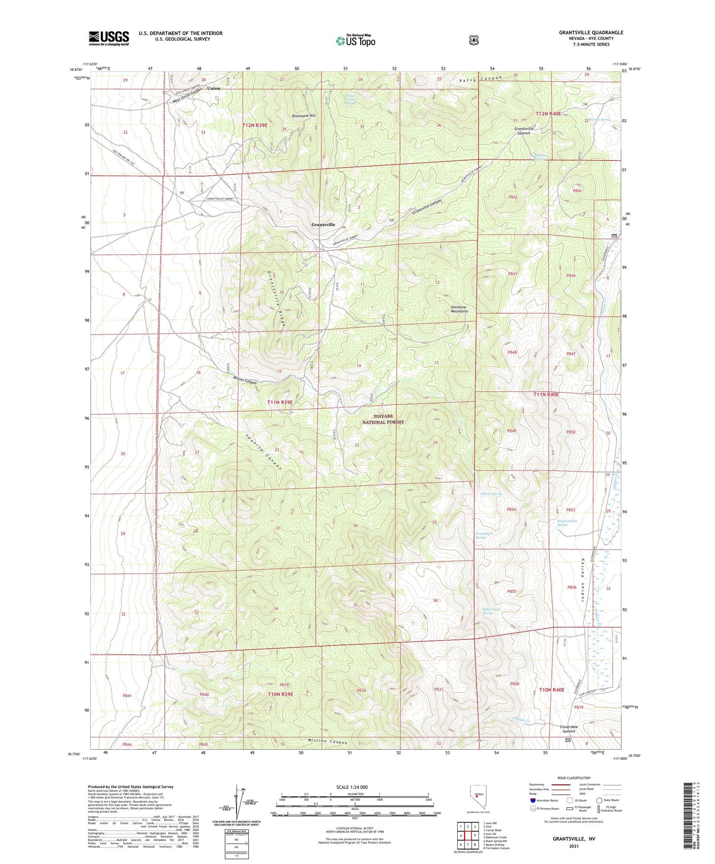
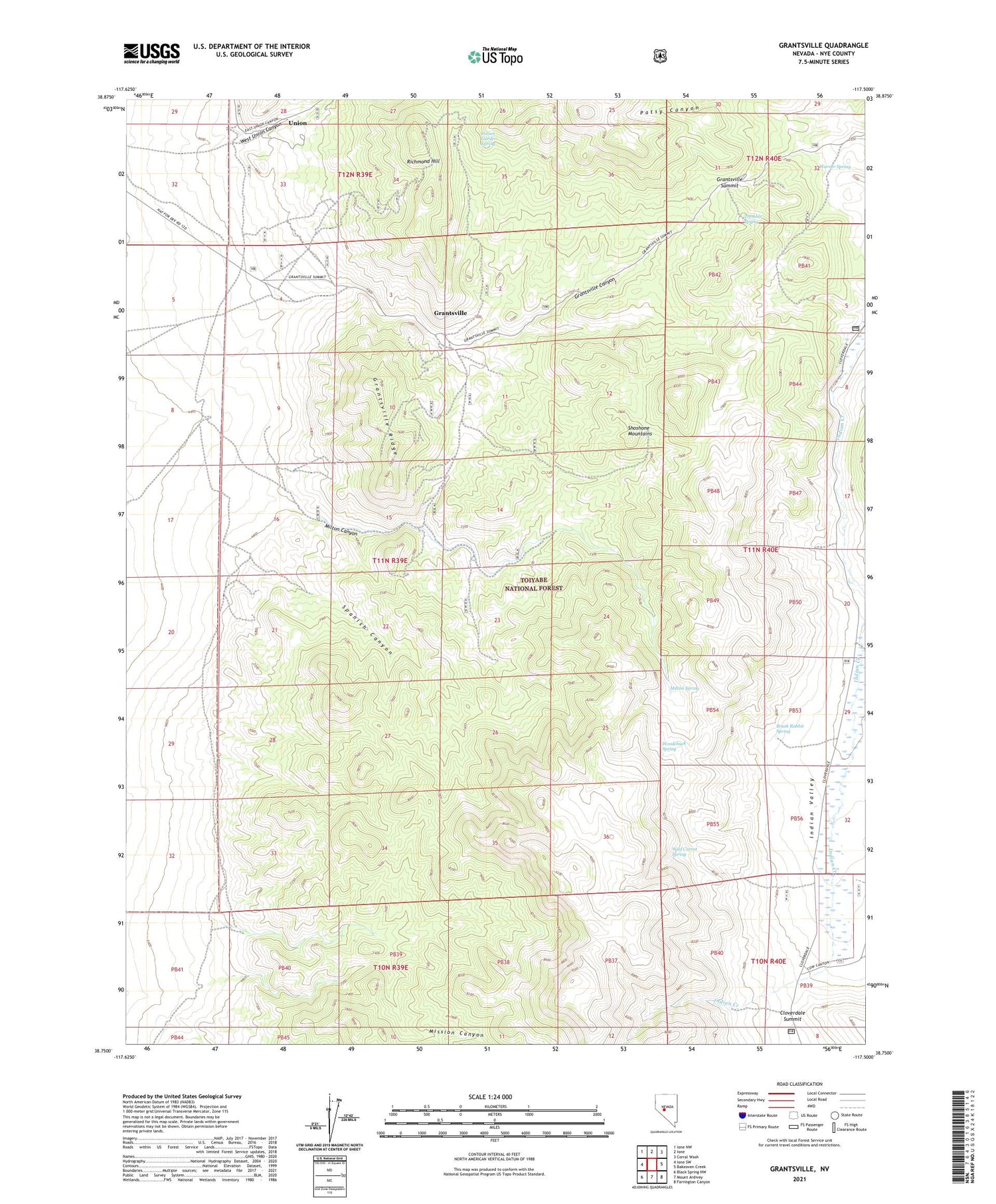
2021 topographic map quadrangle Grantsville in the state of Nevada. Scale: 1:24000. Based on the newly updated USGS 7.5' US Topo map series, this map is in the following counties: Nye. The map contains contour data, water features, and other items you are used to seeing on USGS maps, but also has updated roads and other features. This is the next generation of topographic maps. Printed on high-quality waterproof paper with UV fade-resistant inks.
Quads adjacent to this one:
West: Ione SW
Northwest: Ione NW
North: Ione
Northeast: Corral Wash
East: Bakeoven Creek
Southeast: Farrington Canyon
South: Mount Ardivey
Southwest: Black Spring NW
Contains the following named places: Alexander Shafts, Ames Camp, Berlin-Ichthyosaur State Park, Brooklyn Shaft, Brush Rabbit Spring, Centennial Mine, Cirac Mill, Cloverdale Summit, Grantsville, Grantsville Canyon, Grantsville Mine, Grantsville Post Office, Grantsville Ridge, Grantsville Summit, Indian Garden Spring, Indian Valley Ranch, Milton, Milton Canyon, Milton Canyon Mine, Milton Ranch, Milton Spring, Mission Canyon, Murray Mine, Richmond Hill, San Pedro Mine, Slys Ranch, Spanish Canyon, Tremble Spring, Union, Union Canyon School, Union Post Office, Warner Spring, West Union Canyon, Wild Carrot Spring, Woodchuck Spring