MyTopo
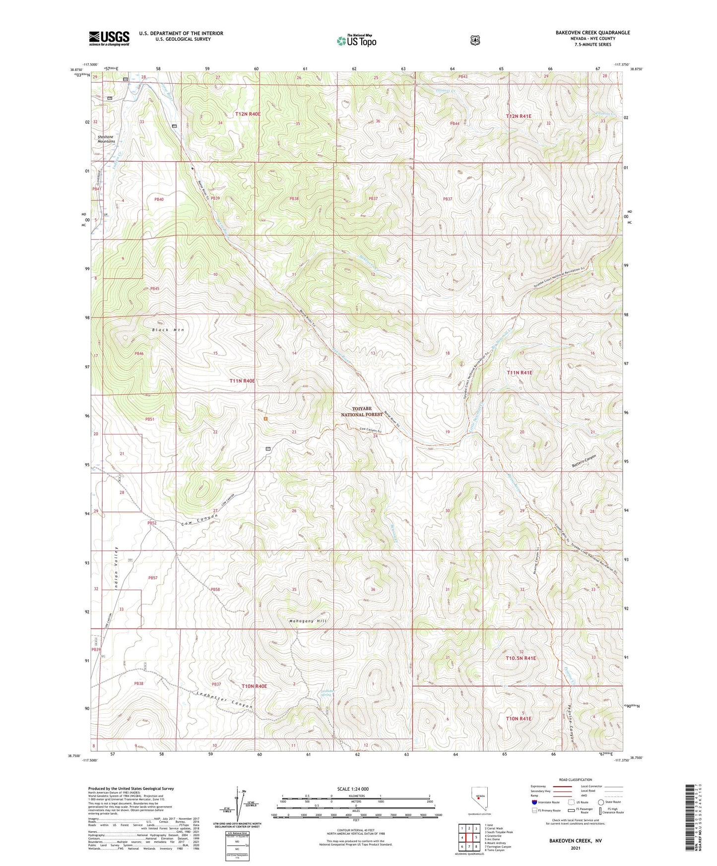
Bakeoven Creek Nevada US Topo Map
Couldn't load pickup availability
Also explore the Bakeoven Creek Forest Service Topo of this same quad for updated USFS data
2021 topographic map quadrangle Bakeoven Creek in the state of Nevada. Scale: 1:24000. Based on the newly updated USGS 7.5' US Topo map series, this map is in the following counties: Nye. The map contains contour data, water features, and other items you are used to seeing on USGS maps, but also has updated roads and other features. This is the next generation of topographic maps. Printed on high-quality waterproof paper with UV fade-resistant inks.
Quads adjacent to this one:
West: Grantsville
Northwest: Ione
North: Corral Wash
Northeast: South Toiyabe Peak
East: Arc Dome
Southeast: Toms Canyon
South: Farrington Canyon
Southwest: Mount Ardivey
This map covers the same area as the classic USGS quad with code o38117g4.
Contains the following named places: Bakeoven Creek, Battero Canyon, Beason Creek, Big Sawmill Creek, Black Mountain, Cow Canyon, Cow Canyon Trailhead, Indian Creek, Indian Valley, Ledbetter Administrative Site, Ledbetter Canyon, Ledbetter Spring, Little Sawmill Creek, Lower Corral, Mahogany Hill, Petes Cabin, Stone Cabin, Stone Cabin Administrative Site, Warners Ranch