MyTopo
The Point Nevada US Topo Map
Couldn't load pickup availability
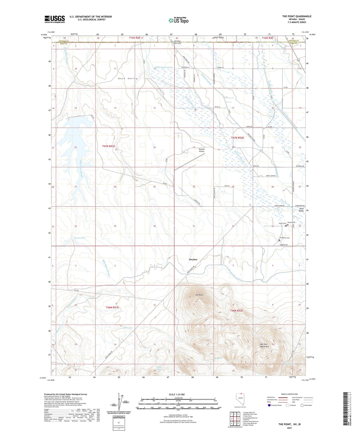
2021 topographic map quadrangle The Point in the states of Nevada, Idaho. Scale: 1:24000. Based on the newly updated USGS 7.5' US Topo map series, this map is in the following counties: Elko, Owyhee. The map contains contour data, water features, and other items you are used to seeing on USGS maps, but also has updated roads and other features. This is the next generation of topographic maps. Printed on high-quality waterproof paper with UV fade-resistant inks.
Quads adjacent to this one:
West: Groundhog Reservoir
Northwest: Juniper Basin SE
North: Mountain View Lake
Northeast: Three Forks
East: Owyhee
Southeast: Ungina Wongo
South: Dry Creek Reservoir
Southwest: Sheep Creek Reservoir
This map covers the same area as the classic USGS quad with code o41116h2.
Contains the following named places: Agency Canal, Chinatown Cemetery, Cold Spring, Coyote Hole, Deep Well, Duck Valley, Duck Valley Canal, Duck Valley Reservation, Lamb Reservoir, Number One Settlement, Owyhee Airport, Owyhee Census Designated Place, Premo Cemetery, Sheep Creek Ditch, Smith Cemetery, Stateline Well, Thacker Lateral, Thacker Spring, The Point, White Rock Lateral, ZIP Code: 89832