MyTopo
Hiller Mountains Nevada US Topo Map
Couldn't load pickup availability
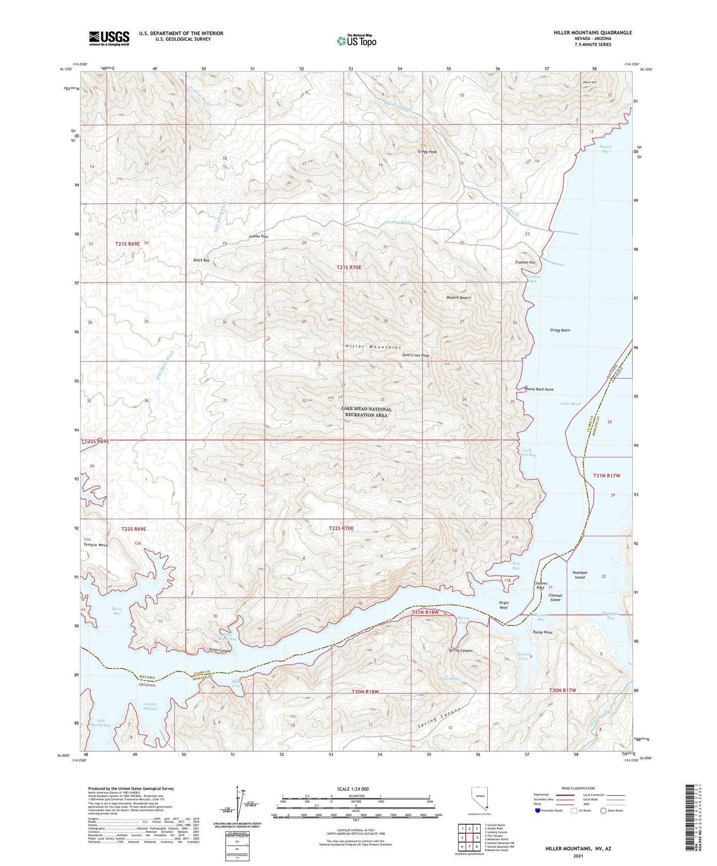
2021 topographic map quadrangle Hiller Mountains in the states of Nevada, Arizona. Scale: 1:24000. Based on the newly updated USGS 7.5' US Topo map series, this map is in the following counties: Clark, Mohave. The map contains contour data, water features, and other items you are used to seeing on USGS maps, but also has updated roads and other features. This is the next generation of topographic maps. Printed on high-quality waterproof paper with UV fade-resistant inks.
Quads adjacent to this one:
West: The Temple
Northwest: Garrett Butte
North: Jumbo Peak
Northeast: Iceberg Canyon
East: Meadview North
Southeast: Meadview South
South: Garnet Mountain NW
Southwest: Senator Mountain NE
This map covers the same area as the classic USGS quad with code o36114a2.
Contains the following named places: Black Box, Burro Bay, Burro Spring, Channel Bay, Channel Island, Channel Reef, Eureka Mine, Gold Cross Bay, Gold Cross Peak, Granite Cove, Gregg Basin, Gregg Peak, Gregg Wash, Greggs Hideout, Hiller Mountains, Hualapai Bay, Hualapai Island, Hualapai Wash, Hualpai Rapids, Joker Mine, Jumbo Mine, Jumbo Pass, Little Burro Bay, Old Senator Mill, Powell Bay, Powell Mountain, Reef Bay, Rocky Point, Round Rock Point, Salt Spring Bay, Scanlon Bay, Scanlon Hill, Scanlon Wash, Slide Cove, Smith Ranch, Spring Canyon, Spring Cove, Temple Mesa, Union Mine, Virgin Reef, Wild Burro Wash