MyTopo
The Temple Nevada US Topo Map
Couldn't load pickup availability
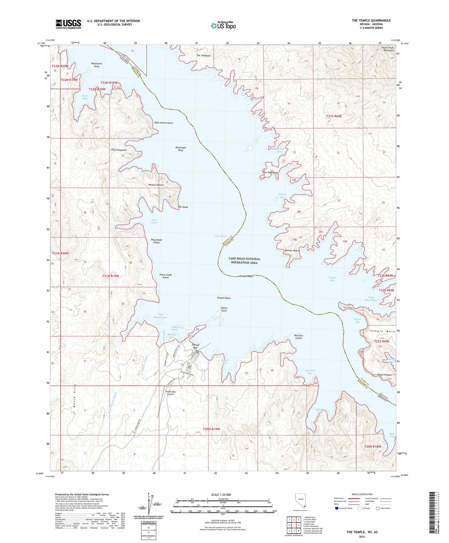
2021 topographic map quadrangle The Temple in the states of Arizona, Nevada. Scale: 1:24000. Based on the newly updated USGS 7.5' US Topo map series, this map is in the following counties: Clark, Mohave. The map contains contour data, water features, and other items you are used to seeing on USGS maps, but also has updated roads and other features. This is the next generation of topographic maps. Printed on high-quality waterproof paper with UV fade-resistant inks.
Quads adjacent to this one:
West: Bonelli Bay
Northwest: Middle Point
North: Garrett Butte
Northeast: Jumbo Peak
East: Hiller Mountains
Southeast: Garnet Mountain NW
South: Senator Mountain NE
Southwest: Senator Mountain NW
This map covers the same area as the classic USGS quad with code o36114a3.
Contains the following named places: Boat Wreck Point, Decision Island, Delmar Bay, Delmar Butte, Gateway Cove, Grebe Bay, Haystack Bay, Heron Point, Houseboat Island, Ladder Cove, Mesa Cove, Monkey Cove, Monkey Cove Spring, Mushroom Reef, Napoleons Tomb, Plane Crash Island, Sawtooth Bay, Striper Bay, Teal Coves, Temple Bar, Temple Bar Airport, Temple Bar Boat Anchorage, Temple Bar Marina, Temple Bar Mill, Temple Basin, Temple Bay, Temple Wash, The Campanile, The Haystacks, The Head, The Jawbone, The Temple, Trail Rapids Bay, Trail Rapids Wash, Virgin Canyon, Wild Burro Bay