MyTopo
I X L Canyon Nevada US Topo Map
Couldn't load pickup availability
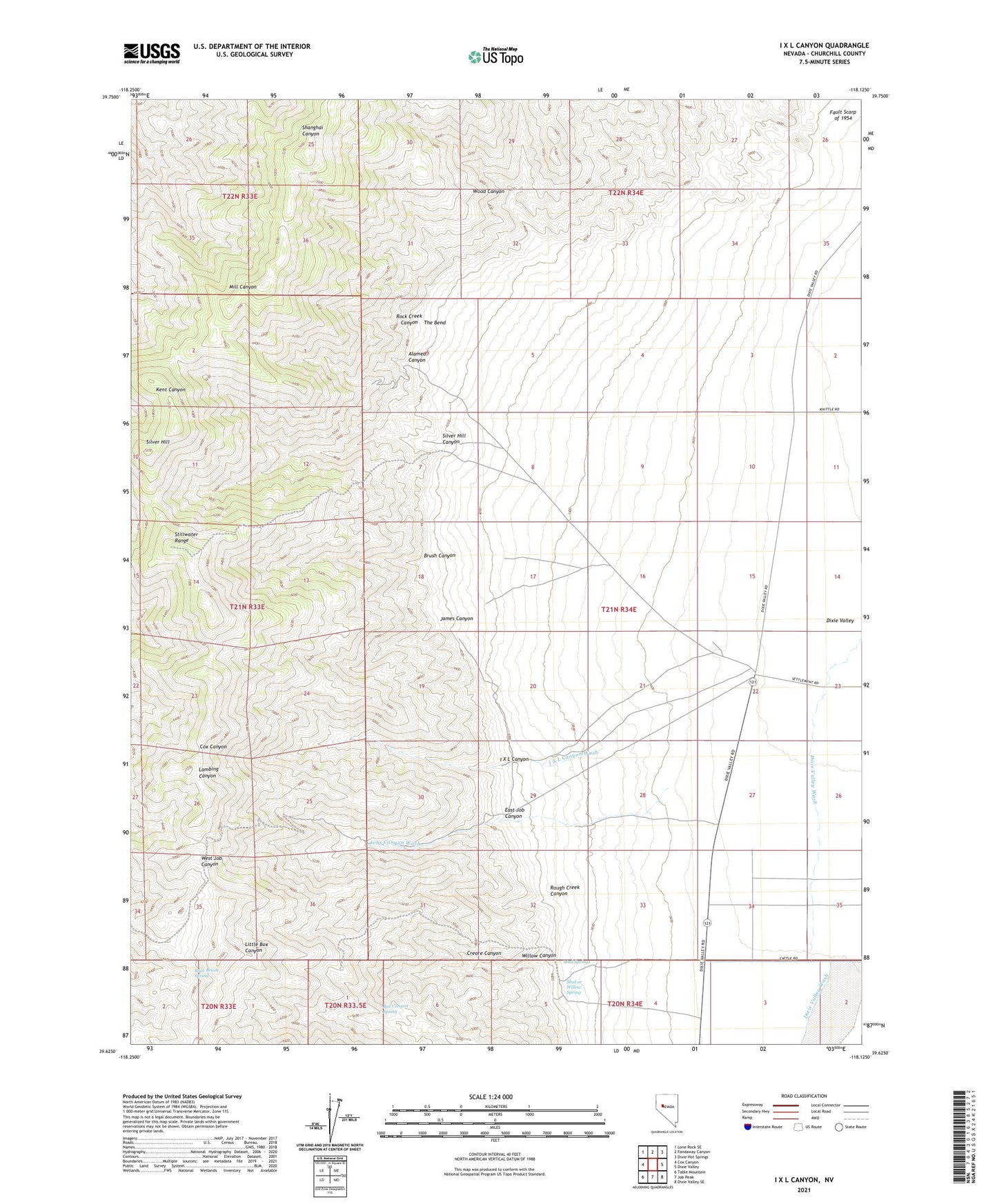
2021 topographic map quadrangle I X L Canyon in the state of Nevada. Scale: 1:24000. Based on the newly updated USGS 7.5' US Topo map series, this map is in the following counties: Churchill. The map contains contour data, water features, and other items you are used to seeing on USGS maps, but also has updated roads and other features. This is the next generation of topographic maps. Printed on high-quality waterproof paper with UV fade-resistant inks.
Quads adjacent to this one:
West: Cox Canyon
Northwest: Lone Rock SE
North: Fondaway Canyon
Northeast: Dixie Hot Springs
East: Dixie Valley
Southeast: Dixie Valley SE
South: Job Peak
Southwest: Table Mountain
Contains the following named places: Alameda Canyon, Box Canyon Spring, Brush Canyon, Buck Brush Spring, Creore Canyon, Creore Mine, East Job Canyon, I X L Canyon, I X L Canyon Wash, James Canyon, Jobs Canyon Wash, Mud or Willow Spring, Mud Springs, Rock Creek Canyon, Rough Creek Canyon, Silver Hill, Silver Hill Canyon, Silver Hills Mining District, The Bend, Willow Canyon, Wood Canyon