MyTopo
Trident Peak Nevada US Topo Map
Couldn't load pickup availability
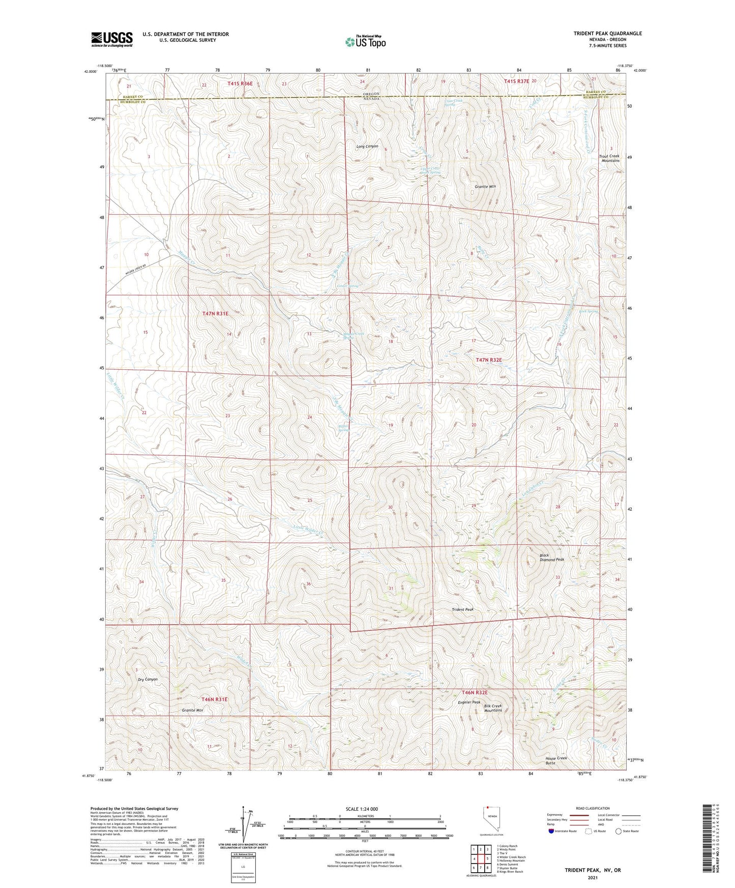
2021 topographic map quadrangle Trident Peak in the state of Nevada. Scale: 1:24000. Based on the newly updated USGS 7.5' US Topo map series, this map is in the following counties: Humboldt, Harney. The map contains contour data, water features, and other items you are used to seeing on USGS maps, but also has updated roads and other features. This is the next generation of topographic maps. Printed on high-quality waterproof paper with UV fade-resistant inks.
Quads adjacent to this one:
West: Wilder Creek Ranch
Northwest: Colony Ranch
North: Windy Point
Northeast: The V
East: Holloway Mountain
Southeast: Kings River Ranch
South: Shyster Butte
Southwest: Denio Summit
Contains the following named places: Black Diamond Peak, Buster Springs, Butte Creek, Catlow Mine, Center Spring, Crow Creek Spring, Engeler Peak, Granite Mountain, Jack Spade Cabin, Jensen Mine, Lucky Strike Mine, Maggie Creek Spring, Miller Corral, Miller Trough, North Branch Maggie Creek, Rock Spring, Sisson Cabin, Slater Mine, Slatterly Cabin, South Branch Maggie Creek, Trident Peak, Upper Crow Creek Spring, Woodward Cabin