MyTopo
Kinkaid Nevada US Topo Map
Couldn't load pickup availability
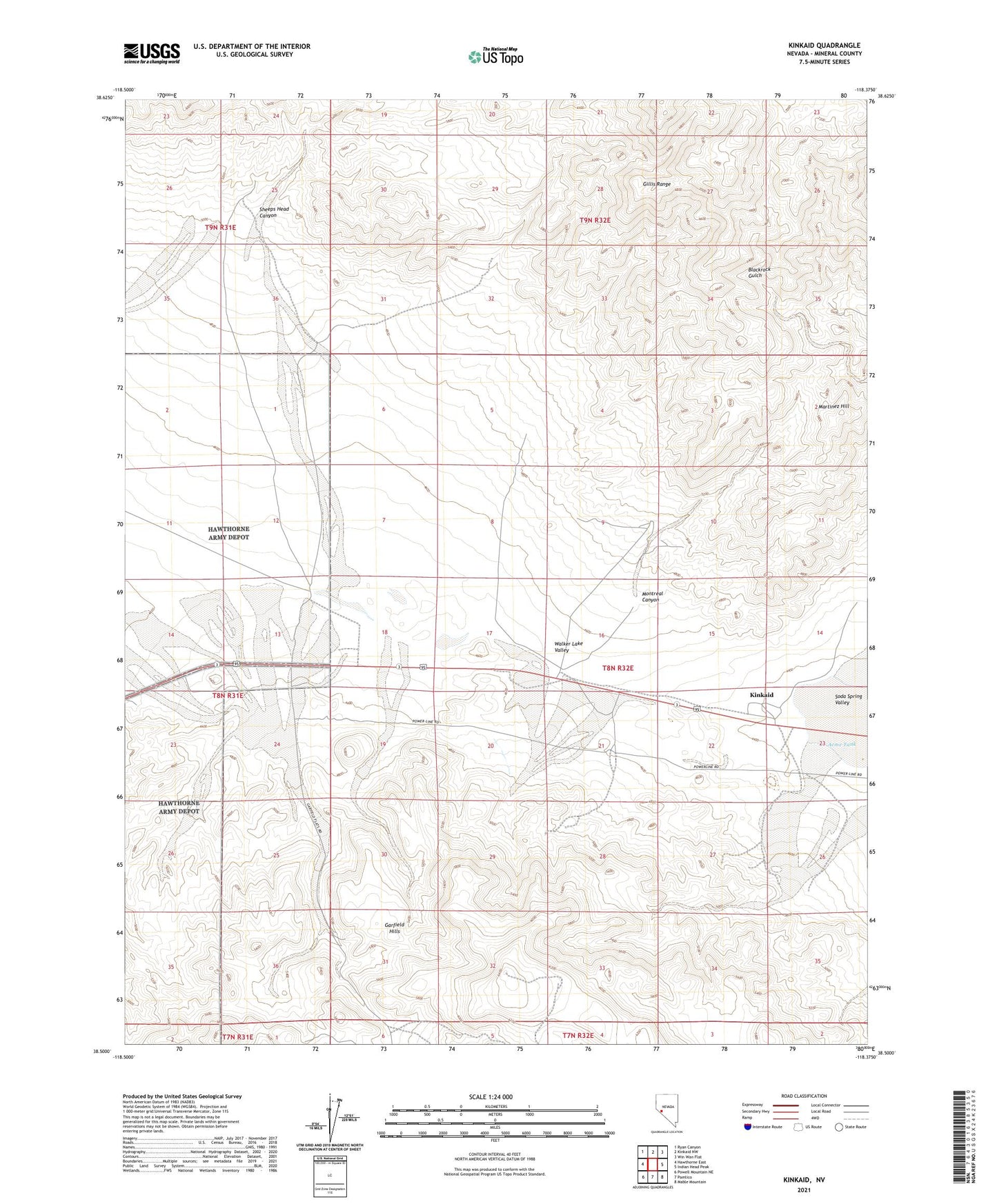
2021 topographic map quadrangle Kinkaid in the state of Nevada. Scale: 1:24000. Based on the newly updated USGS 7.5' US Topo map series, this map is in the following counties: Mineral. The map contains contour data, water features, and other items you are used to seeing on USGS maps, but also has updated roads and other features. This is the next generation of topographic maps. Printed on high-quality waterproof paper with UV fade-resistant inks.
Quads adjacent to this one:
West: Hawthorne East
Northwest: Ryan Canyon
North: Kinkaid NW
Northeast: Win Wan Flat
East: Indian Head Peak
Southeast: Mable Mountain
South: Pamlico
Southwest: Powell Mountain NE
Contains the following named places: Acme Tank, Bismark Mine, Kincaid Reservoir, Kinkaid, Kinkaid Microwave Station, Kinkead Mill, Martinez Hill, Mineral County, Montreal Canyon, Montreal Mine, Sheeps Head Canyon